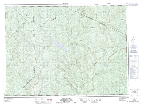
021N09 Grandmaison Canada topo map, 1:50,000 scale
021N09 Grandmaison NRCAN topographic map.
Includes UTM and GPS geographic coordinates (latitude and longitude). This 50k scale map is suitable for hiking, camping, and exploring, or you could frame it as a wall map.
Printed on-demand using high resolution, on heavy weight and acid free paper, or as an upgrade on a variety of synthetic materials.
Topos available on paper, Waterproof, Poly, or Tyvek. Usually shipping rolled, unless combined with other folded maps in one order.
- Product Number: NRCAN-021N09
- Parent Topo: TOPO-021N
- Map ID also known as: 021N09, 21N9, 21N09
- Unfolded Size: Approximately 26" high by 36" wide
- Weight (paper map): ca. 55 grams
- Map Type: POD NRCAN Topographic Map
- Map Scale: 1:50,000
- Geographical region: New Brunswick, Canada
Neighboring Maps:
All neighboring Canadian topo maps are available for sale online at 1:50,000 scale.
Purchase the smaller scale map covering this area: Topo-021N
Spatial coverage:
Topo map sheet 021N09 Grandmaison covers the following places:
- Dégelis - Third Falls - Ango - Asselin - Auclair - Madawaska - Restigouche - Rivière-Verte - Rouillard - Saint-Joseph - Saint-Quentin - Barrage Caribou - Barrage du Grand-Lac-Benedict - Étangs du Beazley - First Lake - Grand lac Benedict - La Queue-de-Poêlon - Lac à Foin - Lac Beazley - Lac Caribou - Lac du Bouleau - Lac Iroquois - Lac Morrison - Lac Richie - Lac Ritchie - Lac Vert - Lacs Jumeaux - North Quisibis Lake - Petit lac Benedict - Second Lake - Montagne du Benedict - Monts Notre-Dame - Sunset Peak - Témiscouata - Zec Owen - Arvin Brook - Bear Brook - Beaver Brook - Belanger Brook - Belone Brook - Benedict Brook - Branche à Charles - Brown Brook - Burnt Camp Brook - Cedar Brook - Charles Fork - Couturier Brook - Doucette Brook - Dufour Brook - East Branch Iroquois River (Petite rivière Iroquois) - East Iroquois River - Eight Mile Brook - Eightmile Brook - Falls Brook - Forks Branch - Fraser Brook - Gagne Brook - Grandmaison Brook - Green River - Green River - Halfway Brook - Iroquois River - Iroquois River (Rivière Iroquois) - Island Brook - Jalbert Brook - Knox Fork - Lake Branch - Lake Branch - Lake Branch - Lake Brook - Left Hand Branch Belone Brook - Lefthand Belone Brook - Levesque Brook - Little Bear Brook - Little Forks Branch - Little Forks Branch - Little Forks Branch Green River - Little Forks River - Little Main Restigouche River - Lunt Brook - Lunts Brook - Main Branch - Moose Valley Brook - Nine Mile Brook - Ninemile Brook - Petit ruisseau Belone - Petite rivière du Lac - Petite rivière Iroquois - Petite rivière Savane - Restigouche River - Restigouche River - Richards Brook - Right Hand Branch Belone Brook - Right Hand Branch Green River - Righthand Belone Brook - Rivière Iroquois - Rivière Iroquois - Rivière Lachaine - Rivière Madawaska - Rivière Owen - Rivière Verte - Ruisseau à Lévesque - Ruisseau Amyot - Ruisseau Beazley - Ruisseau Bélanger - Ruisseau Bélanger - Ruisseau Benedict - Ruisseau Caribou - Ruisseau des Bogues - Ruisseau des Saults - Ruisseau du Bouleau - Ruisseau du Coin - Ruisseau du Coin - Ruisseau Dufour - Ruisseau Dufour - Ruisseau Fournier - Ruisseau Goueg - Ruisseau Horseback - Ruisseau Iroquois - Ruisseau Morrison - Ruisseau Napoléon - Ruisseau Plourde - Ruisseau Richard - Ruisseau Richard - Ruisseau Ritchie - Ruisseau Teed - Ruisseau Victoire - Ruisseau Victoire - Ruisseau Victory - Screw Brook - Teed Brook - Thibodeau Brook - Upper Main Branch - Watson Brook - West Branch Gounamitz River - West Branch Iroquois River - Winding Eddy Brook - Charles Forks - Knox Forks - Les Fourches - Ciquart - Grandmaison - Halfway Depot - Patrieville - Rang-des-Bossé - St. Joseph Settlement - Sweeney Settlement - Étangs du Benedict - Lejeune - Sainte-Rose-du-Dégelé - Sainte-Rose-du-Dégelis - Saint-Godard-de-Lejeune


