
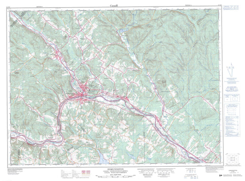
021N08 Edmundston Canada topo map, 1:50,000 scale
021N08 Edmundston NRCAN topographic map.
Includes UTM and GPS geographic coordinates (latitude and longitude). This 50k scale map is suitable for hiking, camping, and exploring, or you could frame it as a wall map.
Printed on-demand using high resolution, on heavy weight and acid free paper, or as an upgrade on a variety of synthetic materials.
Topos available on paper, Waterproof, Poly, or Tyvek. Usually shipping rolled, unless combined with other folded maps in one order.
- Product Number: NRCAN-021N08
- Parent Topo: TOPO-021N
- Map ID also known as: 021N08, 21N8, 21N08
- Unfolded Size: Approximately 26" high by 36" wide
- Weight (paper map): ca. 55 grams
- Map Type: POD NRCAN Topographic Map
- Map Scale: 1:50,000
- Geographical region: New Brunswick, Canada
Neighboring Maps:
All neighboring Canadian topo maps are available for sale online at 1:50,000 scale.
Purchase the smaller scale map covering this area: Topo-021N
Spatial coverage:
Topo map sheet 021N08 Edmundston covers the following places:
- Edmundston - Deuxième Sault - Second Falls - Madawaska - Rivière-Verte - Saint-Basile - Saint-Hilaire - Saint-Jacques - St. Basile 10 - Daigle Island - Fifth Island - Fifth Island - Fourth Island - Madawaska Islands - Pine Island - Quisibis Island - Third Island - Étang Deuxième-Sault - Lac à Poisson - Lac de Vase - Côte à Blanchette - Grande Montagne - Mont Farlagne - Montagne Michaud - Pointu de la Rivière Verte - Ancienne gare de Kedgwick - Église anglicane Saint John the Baptist - Former Kedgwick Railway Station - Les Jardins de la République Provincial Park - Saint John the Baptist Anglican Church - Plaine à Jérôme - Plaine des Smyth - Arsenault Brook - Beardsley Brook - Belone Brook - Big Brook - Big Fork Quisibis River (Grande fourche rivière Quisibis) - Big Spring Brook - Blanchette Brook - Branche à Charles - Brown Brook - Charles Branch (Branche à Charles) - Charles Brook - Clearwater Brook - Daigle Brook - Deep Brook - East Branch Iroquois River (Petite rivière Iroquois) - East Iroquois River - Grande fourche rivière Quisibis - Grandmaison Brook - Green River - Hunter Brook - Iroquois River - Iroquois River (Rivière Iroquois) - Island Brook - Israel Brook - Kelly Brook - Lake Branch - Lake Brook - Lavoie Brook - Lavoie Brook - Levesque Brook - Little Fork Quisibis River (Petite fourche rivière Quisibis) - Little Forks River - Little Trout River - Lunt Brook - Lunts Brook - Lynch Brook - Madawaska River - McCoy Brook - Michaud Brook - Michaud Brook - Parent Brook - Petit ruisseau Belone - Petite fourche rivière Quisibis - Petite rivière à la Truite - Petite rivière Iroquois - Prairie Brook - Quisibis River - Quisibis River (Rivière Quisibis) - Rivière à la Truite - Rivière à la Truite - Rivière Iroquois - Rivière Madawaska - Rivière Madawaska - Rivière Quisibis - Rivière Saint-Jean - Rivière Trout - Rivière Verte - Rob Brook - Ruisseau à Arsenault - Ruisseau à Blanchette - Ruisseau à Félix-Martin - Ruisseau à la Coulée Noire - Ruisseau à la Truite - Ruisseau à Lavoie - Ruisseau à Lavoie - Ruisseau à Lévesque - Ruisseau à Michaud - Ruisseau à Nazaire - Ruisseau à Parent - Ruisseau à Patrick - Ruisseau à Pierre la Mélasse - Ruisseau à Thibodeau - Ruisseau à Zépherin - Ruisseau Creux - Ruisseau des Prairies - Ruisseau des Smyth - Ruisseau Deux-Milles - Ruisseau Israël - Ruisseau Marchand - Ruisseau Quatre-Milles - Ruisseau Trois-Milles - Saint John River - Teed Brook - Thibadeau Brook - Thibodeau Brook - Three Mile Brook - Trout River - Two Mile Brook - West Branch Iroquois River - Big Forks Quisibis River - Little Forks Quisibis River - Albertine - Biard - Boniface Bridge - Bossé - Boucher - Bourgoin - Colin - Couturier Siding - Daigle - Davis Mill - Deuxième-Sault - Edmundston Est - Edmundston-Est - Ennemond - Francoeur - Green River - Iroquois - Jalbert - Lavoie Corner - Levesque - Maillet - Martin Settlement - Michaud - Montagne Plate - Montagne-de-la-Croix - Montagne-des-Roy - Montagne-des-Therrien - Moulin-Morneault - Patrieville - Plourd - Plourde - Prime - Quatre-Coins - Quisibis - Rang Deschenes - Rang-des-Bossé - Rang-des-Couturier - Rang-des-Deschêne - Rang-des-Lavoie - Riceville - Rivière Verte - Saint-Basile - Saint-Jacques - Saint-Joseph-de-Madawaska - Second Falls - Sicard - Sirois - St. Joseph - Ste. Anne - Theriault - Verret - Violette - Platin de la Rivière-Verte - Platin de Saint-Basile - Platin de Saint-Hilaire - Rivière-Verte - Sainte-Anne-de-Madawaska - Saint-Hilaire - St. Basile - St. Hilaire - St. Jacques - Ste. Anne de Madawaska - Ste-Anne-de-Madawaska


