
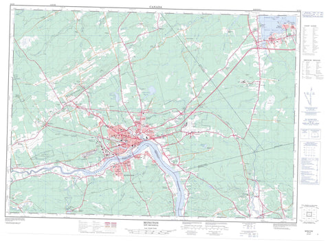
021I02 Moncton Canada topo map, 1:50,000 scale
021I02 Moncton NRCAN topographic map.
Includes UTM and GPS geographic coordinates (latitude and longitude). This 50k scale map is suitable for hiking, camping, and exploring, or you could frame it as a wall map.
Printed on-demand using high resolution, on heavy weight and acid free paper, or as an upgrade on a variety of synthetic materials.
Topos available on paper, Waterproof, Poly, or Tyvek. Usually shipping rolled, unless combined with other folded maps in one order.
- Product Number: NRCAN-021I02
- Parent Topo: TOPO-021I
- Map ID also known as: 021I02, 21I2, 21I02
- Unfolded Size: Approximately 26" high by 36" wide
- Weight (paper map): ca. 55 grams
- Map Type: POD NRCAN Topographic Map
- Map Scale: 1:50,000
- Geographical region: New Brunswick, Canada
Neighboring Maps:
All neighboring Canadian topo maps are available for sale online at 1:50,000 scale.
Purchase the smaller scale map covering this area: Topo-021I
Spatial coverage:
Topo map sheet 021I02 Moncton covers the following places:
- Shediac Bay - Shediac Harbour - South Cove - Belliveau Beach - Parlee Beach - Cape Church - Cornwall Point - Decker Point - McFarlane Point - Milne Point - Outhouse Point - Pointe-du- Chêne - Snake Point - Détroit de Northumberland - Northumberland Strait - Moncton - Belliveau Bluff - Albert - Coverdale - Dorchester - Moncton - Shediac - Westmorland - Soegao 35 - Shediac Island - Folly Lake - Humphreys Mills Pond - Irishtown Road Reservoir - Jones Lake - McLaughlin Road Reservoir - Melanson Settlement Lake - Moncton Reservoir - Moncton Reservoir - Champ de tir Moncton - Moncton Range - Indian Mountain - Lutes Mountain - Scotts Hill - Steeves Mountain - Coverdale United Church - Église unie Coverdale - Maison Pascal-Poirier - Parlee Beach Provincial Park - Babineau Creek - Bailey Brook - Bateman Brook - Batemans Brook - Boundary Creek - Brydon Brook - Butler Creek - Calhoun Brook - Cariboo Brook - Caribou Brook - Cocagne River - Cooks Brook - Coverdale River - Decker Brook - Fox Creek - Gorge Brook - Grindstone Creek - Hall Creek - Halls Creek - Hartley Brook - Humphreys Brook - Island Creek - Jonathan Creek - Jones Brook - Lake Creek - Little River - McFarlane Creek - McQuade Brook - Meadow Brook - Memramcook River - Michaels Creek - Mill Creek - Milner Brook - Mud Creek - North Branch Cocagne River - North Branch Halls Creek - North Cocagne River - North Hall Creek - North River - Ogilvie Brook - Petitcodiac River - Prairie Brook - Rabbit Brook - Rabbit Brook - Scadouc River - Scoudouc River - Seaman Brook - Shaw Brook - Shediac River - Smith Brook - Somers Creek - South Branch Buctouche River - South Buctouche River - Steeves Creek - Stony Creek - Stony Creek - Taits Brook - Turtle Creek - Weisner Brook - West Branch Halls Creek - West Hall Creek - Wilmot Brook - Ballast Ground - Chêne Bank - Coverdale - Dieppe - Riverview - Shediac - Allison - Ammon - Batemans Mills - Belair - Berry Mill Station - Berry Mills - Berry Mills Heights - Boundary Creek - Bridgedale - Calhoun - Canadian Heights - Cape Breton - Catamount - Centennial Place - Chapman Corner - Chartersville - Cherryfield - Codiac Heights - Cooks Brook - Coverdale - Dorchester Crossing - Dorchester Road - Dosco - Dover - East Shediac - Elmwood Estates - Evangeline - Fairview Knoll - Fox Creek - Gaytons - Gilberts Corner - Glen Cairn - Gort - Grove Hamlet - Gunningsville - Harrisville - Harrisville Station - Highland View - Hildegarde - Humphrey - Humphreys Mills - Indian Mountain - Irishtown - La Hêtrière - Lakeburn - Lakeview - Lakeville - Léger - Lewisville - Little Dover - Lower Coverdale - Lower Turtle Creek - Lutes Mountain - Lutesville - Lutz - Magnetic Hill - Malakoff - Mapleton - Mapleton Place - Marsh Junction - McGinleys Corner - McGinley's Corner - McKinnon - McQuade - Meadow Brook - Melanson Settlement - Memramcook - Memramcook East - Memramcook West - Middle Coverdale - Moncton Road - Neils Folly - New Scotland - Odlum Junction - O'Neil - Pacific Junction - Painsec - Painsec Junction - Pine Glen - Point Park - Pointe-du-Chêne - Price - Rings Corner - Riverview Heights - Saint-Anselme - Saint-Philippe - Scadouc - Scotch Settlement - Scoudouc - Shaw Brook - Shediac Cape - Shediac West - St. Philippe - St-Anselme - Steeves Mountain - Stiles Village - Stilesville - Sunny Acres - Sunny Acres West - Sunny Brae - Synton - Tankville - The Bluff - The Gorge - Upper Coverdale - Upper Dover - Valhalla Estate - Valleyview North - Weldon - West Riverview - Westend - Woodhaven Court - Big Meadow - Dieppe Marsh - The Great Barren - Memramcook


