
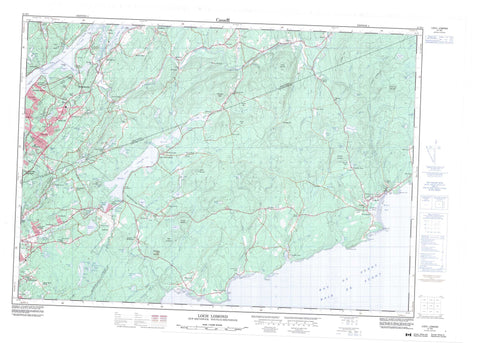
021H05 Loch Lomond Canada topo map, 1:50,000 scale
021H05 Loch Lomond NRCAN topographic map.
Includes UTM and GPS geographic coordinates (latitude and longitude). This 50k scale map is suitable for hiking, camping, and exploring, or you could frame it as a wall map.
Printed on-demand using high resolution, on heavy weight and acid free paper, or as an upgrade on a variety of synthetic materials.
Topos available on paper, Waterproof, Poly, or Tyvek. Usually shipping rolled, unless combined with other folded maps in one order.
- Product Number: NRCAN-021H05
- Parent Topo: TOPO-021H
- Map ID also known as: 021H05, 21H5, 21H05
- Unfolded Size: Approximately 26" high by 36" wide
- Weight (paper map): ca. 55 grams
- Map Type: POD NRCAN Topographic Map
- Map Scale: 1:50,000
- Geographical region: New Brunswick, Canada
Neighboring Maps:
All neighboring Canadian topo maps are available for sale online at 1:50,000 scale.
Purchase the smaller scale map covering this area: Topo-021H
Spatial coverage:
Topo map sheet 021H05 Loch Lomond covers the following places:
- Baie de Fundy - Bay of Fundy - East Bay - Echo Cove - Forester Cove - Forresters Cove - Matthew Cove - Matthews Cove - Meehans Cove - Meenans Cove - Murphy Cove - Quaco Bay - Robinson Cove - Thompson Cove - Tynemouth Creek - West Bay - Berry Beach - Browns Beach - Gardner Creek Beach - Macs Beach - McLeods Beach - Powers Beach - Reeds Beach - St. Martins Beach - Wallace Beach - Dicksons Point - Dicksons Point - East Head - East Red Head - Gondola Point - Honeycomb Point - Kingston Peninsula - MacCormack Point - Macomber Point - McCoy Head - McCumber Point - Oliver Point - Perry Point - Powers Point - Quaco Head - Reeds Point - Rogers Head - The Neck - Wheatons Point - Loch Lomond Thoroughfare - Second Lake Thoroughfare - Third Lake Thoroughfare - Saint John - Forresters Bluff - Hammond - Hampton - Kings - Kingston - Rothesay - Saint John - Saint Martins - Simonds - Upham - Darlings Island - Split Rock - Spoon Island - Adams Lake - Allison Lake - Bates Lake - Bay Lake - Beaver Lake - Berrys Lake - Blackall Lake - Blindman Lake - Bowes Lake - Bradley Lake - Bradley Lakes - Brawley Lake - Browns Lake - Buck Lake - Burley Lake - Calvert Lake - Carpenter Pond - Carvel Lake - Chalet Lake - Cosy Lake - Cruickshank Lake - Darlings Lake - Dolan Lake - Dolan Pond - Donaldson Lake - Douglas Lake - Drummonds Lake - Duck Lake - Duck Pond - Eastern Lakes - First Eastern Lake - Flamingo Lake - Giffin Pond - Grassy Lake - Grassy Lake - Grassy Lakes - Haynes Lake - Hayns Lake - Henry Lake - Hopey Lake - Hosford Lake - Hotsford Lake - Hunter Lake - Irwin Lake - Kelly Lake - Kennebecasis Lake - Kingston Lake - Latimer Lake - Lillis Pond - Lily Lake - Little Ben Lomond Lake - Little River Reservoir - Loch Lomond - Long Lake - MacFarlane Lake - Mackins Lake - Marks Lake - Marsh Lake - McBrien Lake - McCormac Lake - McDonald Lake - McKeever Lake - McLachlan Lake - McVanes Lake - Minote Lake - Molaskey Lake - Mulasky Lake - Mystery Lake - Nugent Pond - Otter Lake - Perch Lake - Ping Pond - Ping Pong Pond - Pitts Lake - Porcupine Lake - Porcupine Lake - Quinn Lake - Ritchie Lake - Robertson Lake - Round Lake - Second Eastern Lake - Second Lake - Shaw Lake - Stoker Lake - Taylor Lake - Terreo Lake - Theobald Lake - Third Lake - Tracey Lake - Treadwell Lake - Waddell Lake - Wolsely Lake - Wood Lake - Baxters Mountain - Bear Mountain - Ben Lomond - Bloomsbury Mountain - Boyles Hill - Burchills Mountain - Drawlin Hill - Golden Grove Mountain - Grove Hill - Handren Hill - Mosher Hill - Mount Misery - Mount Theobald - Porcupine Mountain - Pumpkin Hill - Silver Hill - Spy Glass Hill - Upham Mountain - Vernons Mountain - Weatherbys Peak - Stoneycroft - Burchills Flats - Chapel Flats - Alder Brook - Armstrong Brook - Bain Brook - Bain Brook - Bain Brook - Bains Brook - Bater Brook - Bates Brook - Bean Brook - Beaver Brook - Bedford Brook - Berrys Brook - Beyea Brook - Big Rody Brook - Black River - Black River - Bonney Brook - Bradley Brook - Brandy Brook - Brawley Brook - Clark Brook - Colton Brook - Curry Brook - Cutler Brook - Darlings Brook - Davidson Brook - Doctors Brook - Dolan Brook - Donnelly Brook - East Black River - East Branch Black River - East Branch Irish River - East Irish River - Emerson Creek - Fairweather Brook - Flaglar Brook - Fletcher Brook - Fossil Brook - Gardner Creek - Gardner Creek - Germaine Brook - Grahams Brook - Grassy Brook - Grassy Lake Brook - Greer Brook - Grooms Brook - Half Gallon Brook - Hammond River - Hanford Brook - Hanford Brook - Hosford Brook - Irish River - Isaac Brook - Jacob Brook - Jenny Lind Brook - Kennebecasis River - Langstroth Brook - Little River - Macomber Brook - Macomber Brook - McBrien Brook - McCumber Brook - McGonagle Brook - McGuire Brook - McLennan Brook - Mispec River - Mispek River - Monette Brook - Mosher River - Murphy Brook - North Branch Black River - Nugent Brook - Palmer Brook - Porter Brook - Quaco River - Ratcliffe Brook - Reeds Brook - Ritchie River - Salmon Creek - Salt Springs Brook - Saunders Brook - Scoodic Brook - Snider Brook - South Stream - Stony Brook - Taylors Brook - Ten Mile Creek - Terreo Brook - Titus Brook - Tynemouth Creek - Washburn Brook - Washburn Brook - The Sisters - Hampton - Quispamsis - Rothesay - Bains Corner - Barnesville - Barsa Subdivision - Baxters Corner - Bay View - Ben Lomond - Black River - Black River Road - Blairs - Bonney Road - Burchills Flats - Champlain Heights - Chester - Churchland Road - Clifton - Clifton Royal - Coleraine - Damascus - East Riverside - East Riverside-Kinghurst - Fair View - Fairfield - Fairvale - Fairvale Station - French Village - Gardner Creek - Garnet - Garnett Settlement - Glen Titus - Golden Grove - Gondola Point - Grandview Industrial Park - Greenwood - Greer - Greer Settlement - Grove Hill - Hammond River - Hanford Brook - Hardingville - Hillhurst - Jubilee - Kingshurst - Lake Henry - Lakewood - Lakewood Heights - Latimer Lake - Little River - Loch Lomond - Meehans Corner - Meenans Corner - Model Farm - Mount Prospect - Mount Prospect - Nauwigewauk - Orange Hill - Otty Glen - Perry Point - Porter - Porter Road - Primrose - Pumpkin Hill - Quaco - Quaco Road - Red Head - Reeds Point - Renforth - Ritchie Lake - Riverview Heights - Robertson - Rowley - Shanklin - Sherwood Park - Silver Falls - Smithtown - Stoneycroft - Ten Mile Creek - Titus Mills - Titusville - Tynemouth Creek - Upham - Upper Golden Grove - Upper Loch Lomond - Upperton - Wells - West Quaco - Willow Grove - Gardner Creek Marsh - St. Martins Marsh - East Riverside-Kingshurst - St. Martins


