
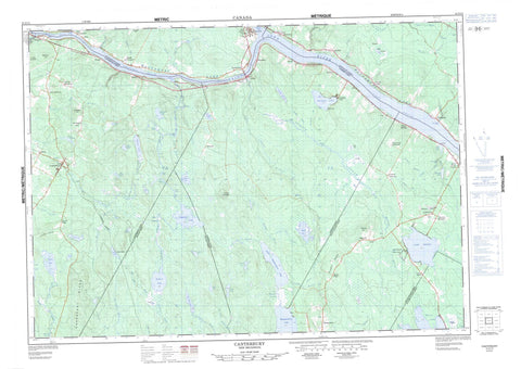
021G14 Canterbury Canada topo map, 1:50,000 scale
021G14 Canterbury NRCAN topographic map.
Includes UTM and GPS geographic coordinates (latitude and longitude). This 50k scale map is suitable for hiking, camping, and exploring, or you could frame it as a wall map.
Printed on-demand using high resolution, on heavy weight and acid free paper, or as an upgrade on a variety of synthetic materials.
Topos available on paper, Waterproof, Poly, or Tyvek. Usually shipping rolled, unless combined with other folded maps in one order.
- Product Number: NRCAN-021G14
- Parent Topo: TOPO-021G
- Map ID also known as: 021G14, 21G14
- Unfolded Size: Approximately 26" high by 36" wide
- Weight (paper map): ca. 55 grams
- Map Type: POD NRCAN Topographic Map
- Map Scale: 1:50,000
- Geographical region: New Brunswick, Canada
Neighboring Maps:
All neighboring Canadian topo maps are available for sale online at 1:50,000 scale.
Purchase the smaller scale map covering this area: Topo-021G
Spatial coverage:
Topo map sheet 021G14 Canterbury covers the following places:
- Bear Island Cove - Culliton Cove - Joslin Brook Basin - Joslin Creek Basin - Shogomoc Cove - Little Magaguadavic Thoroughfare - Big Falls - Joslin Creek Falls - Canterbury - Carleton - Dumfries - Manners Sutton - McAdam - Prince William - Queensbury - Southampton - York - Coac Islands - Great Bear Island - Little Bear Islands - Long Island - Middle Island - Amelia Lake - Big Duck Lake - Big Jamieson Lake - Brown Lake - Carney Lake - Charlie Lake - Clear Lake - Clear Lake - Collicott Pond - Cranberry (Harvey) Lake - Cranberry Lake - Davidson Lake - Deer Lake - Doherty Pond - Doyle Pond - Duck Lake - Fawn Lake - Fox Lake - Grassy Lake - Grieve Lake - Harvey Lake - Indian Lake - Ingraham Lake - Jamieson Lake - Kilburn Lake - Lake Amelia - Lake George - Lily Lake - Little Jamieson Lake - Little Lake - Little Magaguadavic Lake - Long Pond - Mactaquac Lake - Magaguadavic Lake - Moon Pond - Moose Lake - Mud Lake - Pear Lake - Rocky Lake - Second Harvey Lake - Shogomoc Lake - Skiff Lake - Slough Gundy - Slugundy Ponds - Snowshoe Lake - Sullivan Lake - Tom Davis Lake - Tweedie Lake - Waterloo Lake - Annies Mountain - Blaney Ridge - Carroll Ridge - Cranberry Ridge - Dorrington Hill - Dunham Hill - Flat Top Mountain - Magundy Hill - Meductic Hill - Barony Provincial Park - Lake George Provincial Park - Shogomoc Provincial Park - Canoe Rips - Ellegood Rips - Grassy Lake Rips - Indian Rips - Beaver Brook - Black Brook - Bulls Creek - Cann Brook - Clinch Brook - Coac Stream - Cranberry Brook - Cranberry Brook - Davidson Brook - Dead Creek - Deadwater Brook - Deer Lake Brook - Duck Brook - Duck Brook - Dunham Brook - Eel River - Estey Brook - Farnham Brook - Four Mile Brook - Fox Brook - Grassy Lake Brook - Greer Creek - Greers Creek - Hammond Brook - Indian Brook - Jocelyne Brook - Jocelyne Brook - Johnson Brook - Joslin Brook - Joslin Creek - King Brook - Little Cranberry Brook - Little Patterson Brook - Little Pokiok River - Little Pokiok Stream - Magundy Stream - Meadow Brook - Meadow Brook - Mill Brook - Mill Stream - Mud Brook - North Branch Duck Brook - Palfrey Brook - Palfrey Stream - Pine Swamp Brook - Pokiok River - Pokiok Stream - Quigg Brook - Risteen Brook - Rivière Saint-Jean - Saint John River - Serpentine Brook - Shogomoc River - Shogomoc Stream - Sinnots Brook - South Branch Mactaquac Stream - Stony Brook - Sugar Brook - Sullivan Brook - Sullivan Creek - Tweedie Brook - Waterloo Brook - West Branch Shogomoc Stream - West Duck Brook - West Shogomoc River - Big Deadwater - Coac Reach - Kilburn Deadwater - Long Sluice Deadwater - Meductic Reach - Nackawic Bend - Pokiok Reach - Risteen Deadwater - Shogomoc Reach - Nackawic - Allandale - Allandale Station - Barony - Bear Island - Blaney Ridge - Cairds - Carroll Ridge - Carson - Davidson Lake - Day Hill - Deer Lake - Donnelly Settlement - Dorrington Hill - Dow Settlement - Dumfries - Granite Hill - Green Bush - Hawkshaw - Johnson Settlement - Lake George - Lake Road - Lower Pokiok - Lower Prince William - Magaguadavic - Magundy - Marne - Middle Southampton - Murray - Otis - Pokiok - Pokiok Settlement - Prince William - Ritchie - Rosborough Settlement - Shogomoc - Southampton - Temple - Upper Bear Island - Upper Magaguadavic - Upper Prince William - Upper Queensbury - Upper Southampton - Parent Bog - Canterbury - Canterbury Station - Meductic - Rosborough


