
012L12 Lac Cugnet Canada topo map, 1:50,000 scale
012L12 Lac Cugnet NRCAN topographic map.
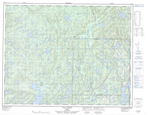
Includes UTM and GPS geographic coordinates (latitude and longitude). This 50k scale map is suitable for hiking, camping, and exploring, or you could frame it as a wall map.
Printed on-demand using high resolution, on heavy weight and acid free paper, or as an upgrade on a variety of synthetic materials.
Topos available on paper, Waterproof, Poly, or Tyvek. Usually shipping rolled, unless combined with other folded maps in one order.
- Product Number: NRCAN-012L12
- Parent Topo: TOPO-012L
- Map ID also known as: 012L12, 12L12
- Unfolded Size: Approximately 26" high by 36" wide
- Weight (paper map): ca. 55 grams
- Map Type: POD NRCAN Topographic Map
- Map Scale: 1:50,000
- Geographical region: Quebec, Canada
Neighboring Maps:
All neighboring Canadian topo maps are available for sale online at 1:50,000 scale.
Purchase the smaller scale map covering this area: Topo-012L
Spatial coverage:
Topo map sheet 012L12 Lac Cugnet covers the following places:
- Baie de l'Ilménite - Pointe aux Orphelins - Pointe Rouge - Passe Kauapauakaht - Longfellow - Parker - Puyjalon - Vigneau - Île Allard - Lac Allard - Lac Alphonse - Lac Antuiahkuhiu - Lac Carré - Lac Cornu - Lac Court - Lac Creux - Lac Cugnet - Lac Danis - Lac de la Limite - Lac des Falaises - Lac Diane - Lac du Chameau - Lac Fortin - Lac Hippocampe - Lac Jean-Clair - Lac Jef - Lac Jennifer - Lac Kahapuauatshitihk - Lac Kaiatuakamat - Lac Katshihtshekakamat - Lac Kaunakaunant - Lac Longfellow - Lac Manitou - Lac Mantuihahkutshiu - Lac Mitshim Mukustshiau - Lac Mitsim Mukustshiau - Lac Nova - Lac Pelletier - Lac Perché - Lac Rideau - Lac Triton - Lac Uauahk - Lac Umuaihiu Miskumi - Lacs Antuiahkuhiu - Lacs Kaunakauan - Petit lac Cugnet - Petit lac Kaunakauan - Petitslacs Umuaihiu Miskumi - Colline Kapenakahkueu Uhtukuan - Rapides Uantitshiu - Rivière Allard - Rivière Croche - Rivière Mingan - Rivière Mingan Nord-Ouest - Rivière Mitshem Kutshieu - Ruisseau Kakuanat - Ruisseau Katatukuatauakaht - Ruisseau Kaunakauan - Ruisseau Mantuiahk - Ruisseau Mista Hatshu - Piste Kakahtsheuepetnant - Kauahtshuahk


