
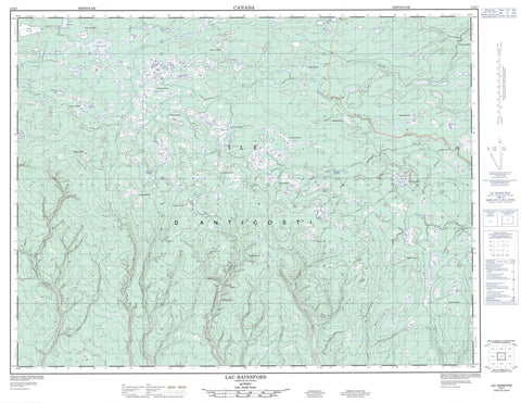
012E07 Lac Rainsford Canada topo map, 1:50,000 scale
012E07 Lac Rainsford NRCAN topographic map.
Includes UTM and GPS geographic coordinates (latitude and longitude). This 50k scale map is suitable for hiking, camping, and exploring, or you could frame it as a wall map.
Printed on-demand using high resolution, on heavy weight and acid free paper, or as an upgrade on a variety of synthetic materials.
Topos available on paper, Waterproof, Poly, or Tyvek. Usually shipping rolled, unless combined with other folded maps in one order.
- Product Number: NRCAN-012E07
- Parent Topo: TOPO-012E
- Map ID also known as: 012E07, 12E7, 12E07
- Unfolded Size: Approximately 26" high by 36" wide
- Weight (paper map): ca. 55 grams
- Map Type: POD NRCAN Topographic Map
- Map Scale: 1:50,000
- Geographical region: Quebec, Canada
Neighboring Maps:
All neighboring Canadian topo maps are available for sale online at 1:50,000 scale.
Purchase the smaller scale map covering this area: Topo-012E
Spatial coverage:
Topo map sheet 012E07 Lac Rainsford covers the following places:
- Lac-Martin - Chute Natiscotec - Anticosti Island - Île d'Anticosti - Étang Bissot - Étang Grégoire - Étang Simard - Lac François-Bélanger - Lac Godin - Lac Jolliet - Lac Létourneau - Lac Louise - Lac Marie-Guyon - Lac Martin - Lac Rainsford - Lac Simard - Lac Vauréal - Parc national d'Anticosti - Petite rivière de la Chaloupe - Rivière aux Plats - Rivière aux Saumons - Rivière Bear - Rivière Bilodeau - Rivière de la Chaloupe - Rivière Digby - Rivière du Cap - Rivière du Pavillon - Rivière du Pavillon Est - Rivière Fairy - Rivière Ferrée - Rivière Iron - Rivière Jupiter - Rivière Maccan - Rivière Maujerol - Rivière Mazerolle - Rivière Metallic - Rivière Métallique - Rivière Mozerold - Rivière Mugaraul - Rivière Natiscotec - Rivière Vauréal - Ruisseau Martin - Champ-des-Gouffres


