
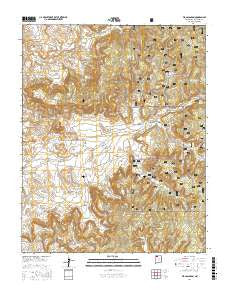
~ Vigas Canyon NM topo map, 1:24000 scale, 7.5 X 7.5 Minute, 2017
Vigas Canyon, New Mexico, USGS topographic map dated 2017.
Includes geographic coordinates (latitude and longitude). This topographic map is suitable for hiking, camping, and exploring, or framing it as a wall map.
Printed on-demand using high resolution imagery, on heavy weight and acid free paper, or alternatively on a variety of synthetic materials.
Topos available on paper, Waterproof, Poly, or Tyvek. Usually shipping rolled, unless combined with other folded maps in one order.
- Product Number: USGS-8692661
- Free digital map download (high-resolution, GeoPDF): Vigas Canyon, New Mexico (file size: 35 MB)
- Map Size: please refer to the dimensions of the GeoPDF map above
- Weight (paper map): ca. 55 grams
- Map Type: POD USGS Topographic Map
- Map Series: US Topo
- Map Verison: Current
- Cell ID: 46912
- Datum: North American Datum of 1983
- Map Projection: Transverse Mercator
- Map Cell Name: Vigas Canyon
- Grid size: 7.5 X 7.5 Minute
- Date on map: 2017
- Map Scale: 1:24000
- Geographical region: New Mexico, United States
Neighboring Maps:
All neighboring USGS topo maps are available for sale online at a variety of scales.
Spatial coverage:
Topo map Vigas Canyon, New Mexico, covers the geographical area associated the following places:
- Vigas Spring - Russel Tank - Temple Tank - Vigas Canyon - B S Mesa - Fir Spring - Candelaria Waterhole - BS Tank - Ciruelas Canyon - L Velarde Water Well - S J 27-5 1 Water Well - Jaramillo Spring - Middle Canyon Tank - Tecolote Spring - Tecolote Canyon - Arroyo Campanero - Vigas Tank - Cereza Mesa - Jaramillo Canyon - Jaramillo Mesa - Agua Bonito Spring - Encino Detention Dam Number 85 - Arroyo Compañero - Cereza Canyon - Honolulu Tank - Deer Tank - Owl Tank - Tuckers Ridge
- Map Area ID: AREA36.62536.5-107.375-107.25
- Northwest corner Lat/Long code: USGSNW36.625-107.375
- Northeast corner Lat/Long code: USGSNE36.625-107.25
- Southwest corner Lat/Long code: USGSSW36.5-107.375
- Southeast corner Lat/Long code: USGSSE36.5-107.25
- Northern map edge Latitude: 36.625
- Southern map edge Latitude: 36.5
- Western map edge Longitude: -107.375
- Eastern map edge Longitude: -107.25


