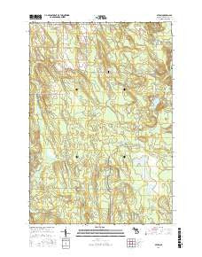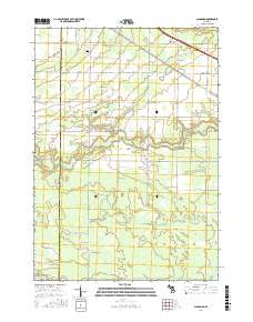
~ Pueblo Bonito NM topo map, 1:24000 scale, 7.5 X 7.5 Minute, Current, 2017
Pueblo Bonito, New Mexico, USGS topographic map dated 2017.
Includes geographic coordinates (latitude and longitude). This topographic map is suitable for hiking, camping, and exploring, or framing it as a wall map.
Printed on-demand using high resolution imagery, on heavy weight and acid free paper, or alternatively on a variety of synthetic materials.
Topos available on paper, Waterproof, Poly, or Tyvek. Usually shipping rolled, unless combined with other folded maps in one order.
- Product Number: USGS-8692643
- Free digital map download (high-resolution, GeoPDF): Pueblo Bonito, New Mexico (file size: 25 MB)
- Map Size: please refer to the dimensions of the GeoPDF map above
- Weight (paper map): ca. 55 grams
- Map Type: POD USGS Topographic Map
- Map Series: US Topo
- Map Verison: Current
- Cell ID: 36588
- Datum: North American Datum of 1983
- Map Projection: Transverse Mercator
- Map Cell Name: Pueblo Bonito
- Grid size: 7.5 X 7.5 Minute
- Date on map: 2017
- Map Scale: 1:24000
- Geographical region: New Mexico, United States
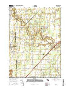
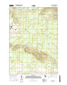
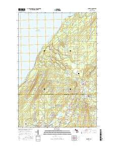
Neighboring Maps:
All neighboring USGS topo maps are available for sale online at a variety of scales.
Spatial coverage:
Topo map Pueblo Bonito, New Mexico, covers the geographical area associated the following places:
- Hungo Pavie (historical) - Kin Kletso (historical) - West Mesa - Kin Nahasbasd (historical) - Pueblo del Arroyo (historical) - Sheep Camp Canyon - Weritos Rincon - Pueblo Bonito Ranger Station - South Mesa - Putnam - Casa Chiquita (historical) - Kimbeto Wash - C C Field Water Well - Gallo Campground - Mockingbird Canyon - South Gap - Putnam Post Office (historical) - Alto Chjiquito - Chaco Culture National Historical Park - Casa Rinconada (historical) - Chaco Canyon - Chacra Mesa - Clys Canyon - Betonnie Tsosie Wash - Pueblo Alto (historical) - Heshoda Bitsulliya - 15R-307 Water Well - Chaco Canyon Weather Station - Fajada Butte - Yazzi Well - Alto Grande - Willeto Well - Una Vida (historical) - Fajada Wash - Chaco Post Office (historical) - Gallo Wash - Chaco Canyon Trading Post - Pueblo Bonito - CC Kernodle Number 1 Water Well - Tsin Kletzin (historical) - Chettro Kettle
- Map Area ID: AREA36.12536-108-107.875
- Northwest corner Lat/Long code: USGSNW36.125-108
- Northeast corner Lat/Long code: USGSNE36.125-107.875
- Southwest corner Lat/Long code: USGSSW36-108
- Southeast corner Lat/Long code: USGSSE36-107.875
- Northern map edge Latitude: 36.125
- Southern map edge Latitude: 36
- Western map edge Longitude: -108
- Eastern map edge Longitude: -107.875