
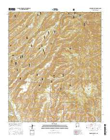
~ Hendricks Peak NM topo map, 1:24000 scale, 7.5 X 7.5 Minute, 2017
Hendricks Peak, New Mexico, USGS topographic map dated 2017.
Includes geographic coordinates (latitude and longitude). This topographic map is suitable for hiking, camping, and exploring, or framing it as a wall map.
Printed on-demand using high resolution imagery, on heavy weight and acid free paper, or alternatively on a variety of synthetic materials.
Topos available on paper, Waterproof, Poly, or Tyvek. Usually shipping rolled, unless combined with other folded maps in one order.
- Product Number: USGS-8687371
- Free digital map download (high-resolution, GeoPDF): Hendricks Peak, New Mexico (file size: 36 MB)
- Map Size: please refer to the dimensions of the GeoPDF map above
- Weight (paper map): ca. 55 grams
- Map Type: POD USGS Topographic Map
- Map Series: US Topo
- Map Verison: Current
- Cell ID: 20096
- Datum: North American Datum of 1983
- Map Projection: Transverse Mercator
- Map Cell Name: Hendricks Peak
- Grid size: 7.5 X 7.5 Minute
- Date on map: 2017
- Map Scale: 1:24000
- Geographical region: New Mexico, United States
Neighboring Maps:
All neighboring USGS topo maps are available for sale online at a variety of scales.
Spatial coverage:
Topo map Hendricks Peak, New Mexico, covers the geographical area associated the following places:
- Mud Springs Mountain - Horse Tank - Rosencrans Tank - Gatlin Tank - Dale Tank - McKnight Well - Upper Well - Juan Mesa Tank - Ridge Tank Number Two - Trap Tank - Quaking Asp Canyon - Pothole Tank - East Canyon - Turkey Dam - Dutchman Tank - Mimbres Division - Yates Spring Canyon - City of Rocks - Nicholi Tank - Pasture Spring - Ott Tank - Spring Canyon - Bear Canyon Reservoir - JT Tank - Pit Tank - Kelly Mesa Tank - Trail Canyon Tank - Dutchman Canyon - Bear Canyon Reservoir Dam - Trap Spring - Juan Mesa Tank Number Two - Juniper Tank - Kelly Ridge Tank - East Tank - Aspen Spring - Rabb Spring - Cabin Spring - Skillet Mesa - Valentine Canyon - Lake Superior Tank - Pale Tank - North Water Tank - Rabb Park - Pit Tank - Stitzel Tank - Davis Tank - Middle Tank - Pence Tank - Valentine Spring - Brushy Canyon - Water Canyon Tank - Rabb Canyon - Race Spring - Lower Well - Hendricks Peak - Cureton Canyon - Bear Trap Canyon - Rays Tank - Girty Spring - Rosencran Canyon - Little McKnight Canyon - Bear Canyon
- Map Area ID: AREA3332.875-108-107.875
- Northwest corner Lat/Long code: USGSNW33-108
- Northeast corner Lat/Long code: USGSNE33-107.875
- Southwest corner Lat/Long code: USGSSW32.875-108
- Southeast corner Lat/Long code: USGSSE32.875-107.875
- Northern map edge Latitude: 33
- Southern map edge Latitude: 32.875
- Western map edge Longitude: -108
- Eastern map edge Longitude: -107.875


