
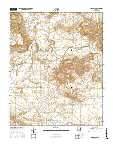
~ Trinchera Creek NM topo map, 1:24000 scale, 7.5 X 7.5 Minute, 2017
Trinchera Creek, New Mexico, USGS topographic map dated 2017.
Includes geographic coordinates (latitude and longitude). This topographic map is suitable for hiking, camping, and exploring, or framing it as a wall map.
Printed on-demand using high resolution imagery, on heavy weight and acid free paper, or alternatively on a variety of synthetic materials.
Topos available on paper, Waterproof, Poly, or Tyvek. Usually shipping rolled, unless combined with other folded maps in one order.
- Product Number: USGS-8660996
- Free digital map download (high-resolution, GeoPDF): Trinchera Creek, New Mexico (file size: 27 MB)
- Map Size: please refer to the dimensions of the GeoPDF map above
- Weight (paper map): ca. 55 grams
- Map Type: POD USGS Topographic Map
- Map Series: US Topo
- Map Verison: Current
- Cell ID: 45677
- Datum: North American Datum of 1983
- Map Projection: Transverse Mercator
- Map Cell Name: Trinchera Creek
- Grid size: 7.5 X 7.5 Minute
- Date on map: 2017
- Map Scale: 1:24000
- Geographical region: New Mexico, United States
Neighboring Maps:
All neighboring USGS topo maps are available for sale online at a variety of scales.
Spatial coverage:
Topo map Trinchera Creek, New Mexico, covers the geographical area associated the following places:
- Trinchera Tank - Trinchera Well - Horse Pasture Tank - Sink Hole Gap Reservoir Dam - Frio Tank - Carpenter Windmill - Antelope Tank - Sink Hole Gap Stock Tank - Monitor Windmill - Llano Pens - Rockpile Tanks - Three P Trap Windmill - Six Foot Windmill - Llano Tank - Gartersnake Windmill - Trinchera Creek - Duck Tank - Canadian Windmill - Sacaton Tank - Government Tank - Carpenter Creek - Loma Tank - North Trap Tank - Road Creek - Horseshoe Bend Windmill - Medina Canyon - Artesian Windmill - Rattlesnake Tank - Bond - Mimosa Creek - Rattlesnake Creek - Atarque Windmill - Carpenter Mesa - Loma Cita Tank - Rincon Tank - Chappell-Spade Ranch - Horseshoe Bend - Atarque Creek
- Map Area ID: AREA35.37535.25-103.875-103.75
- Northwest corner Lat/Long code: USGSNW35.375-103.875
- Northeast corner Lat/Long code: USGSNE35.375-103.75
- Southwest corner Lat/Long code: USGSSW35.25-103.875
- Southeast corner Lat/Long code: USGSSE35.25-103.75
- Northern map edge Latitude: 35.375
- Southern map edge Latitude: 35.25
- Western map edge Longitude: -103.875
- Eastern map edge Longitude: -103.75


