
~ Cherokee Valley NM topo map, 1:24000 scale, 7.5 X 7.5 Minute, 2017
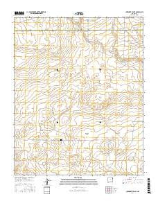
Cherokee Valley, New Mexico, USGS topographic map dated 2017.
Includes geographic coordinates (latitude and longitude). This topographic map is suitable for hiking, camping, and exploring, or framing it as a wall map.
Printed on-demand using high resolution imagery, on heavy weight and acid free paper, or alternatively on a variety of synthetic materials.
Topos available on paper, Waterproof, Poly, or Tyvek. Usually shipping rolled, unless combined with other folded maps in one order.
- Product Number: USGS-8660970
- Free digital map download (high-resolution, GeoPDF): Cherokee Valley, New Mexico (file size: 24 MB)
- Map Size: please refer to the dimensions of the GeoPDF map above
- Weight (paper map): ca. 55 grams
- Map Type: POD USGS Topographic Map
- Map Series: US Topo
- Map Verison: Current
- Cell ID: 8347
- Datum: North American Datum of 1983
- Map Projection: Transverse Mercator
- Map Cell Name: Cherokee Valley
- Grid size: 7.5 X 7.5 Minute
- Date on map: 2017
- Map Scale: 1:24000
- Geographical region: New Mexico, United States
Neighboring Maps:
All neighboring USGS topo maps are available for sale online at a variety of scales.
Spatial coverage:
Topo map Cherokee Valley, New Mexico, covers the geographical area associated the following places:
- 05340 Water Well - 05321 Water Well - Burks Ranch - 05444 Water Well - 05318 Water Well - 05443 Water Well - 05354 Water Well - Faus Well - 05359 Water Well - Red Windmill - Vandergrift Tank - 05442 Water Well - Robertson - Waller Well - Graveyard Well - Kaufman Ranch - 05287 Water Well - 05286 Water Well - Smith-Cox Well - 00202 Water Well - Cammack - Johnson - 05322 Water Well - Cherokee Valley - 05320 Water Well - 05325 Water Well - 05324 Water Well - Campbell Well - Holcolm Well - Stoner Well - 05328 Water Well - 05319 Water Well - Johnson Well - Arnold Well - Sand Hill Windmill - Haufman - North Fork Minneosa Creek - Johnson Ranch - 05326 Water Well - Cherokee Valley Cemetery - South Well - Kuper - Garrett Well - Alford Well - Dessum Well - Van Wart Well
- Map Area ID: AREA35.7535.625-103.375-103.25
- Northwest corner Lat/Long code: USGSNW35.75-103.375
- Northeast corner Lat/Long code: USGSNE35.75-103.25
- Southwest corner Lat/Long code: USGSSW35.625-103.375
- Southeast corner Lat/Long code: USGSSE35.625-103.25
- Northern map edge Latitude: 35.75
- Southern map edge Latitude: 35.625
- Western map edge Longitude: -103.375
- Eastern map edge Longitude: -103.25


