
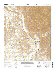
~ Canteen Canyon NM topo map, 1:24000 scale, 7.5 X 7.5 Minute, 2017
Canteen Canyon, New Mexico, USGS topographic map dated 2017.
Includes geographic coordinates (latitude and longitude). This topographic map is suitable for hiking, camping, and exploring, or framing it as a wall map.
Printed on-demand using high resolution imagery, on heavy weight and acid free paper, or alternatively on a variety of synthetic materials.
Topos available on paper, Waterproof, Poly, or Tyvek. Usually shipping rolled, unless combined with other folded maps in one order.
- Product Number: USGS-8660624
- Free digital map download (high-resolution, GeoPDF): Canteen Canyon, New Mexico (file size: 31 MB)
- Map Size: please refer to the dimensions of the GeoPDF map above
- Weight (paper map): ca. 55 grams
- Map Type: POD USGS Topographic Map
- Map Series: US Topo
- Map Verison: Current
- Cell ID: 7101
- Datum: North American Datum of 1983
- Map Projection: Transverse Mercator
- Map Cell Name: Canteen Canyon
- Grid size: 7.5 X 7.5 Minute
- Date on map: 2017
- Map Scale: 1:24000
- Geographical region: New Mexico, United States
Neighboring Maps:
All neighboring USGS topo maps are available for sale online at a variety of scales.
Spatial coverage:
Topo map Canteen Canyon, New Mexico, covers the geographical area associated the following places:
- Juniper Spring - Upper Gila Site Number 11 Dam - Brock Canyon - Clark Canyon Dam - Cherry Spring - Upper Gila Site Number 10 Dam - Canteen Canyon - Davis Canyon - Upper Gila Site Number Eight Dam - Fall Canyon - Rough Canyon - Spar Canyon - Upper Gila Site Number Six Dam - Indian Canyon - Upper Gila Site Number Nine Dam - Wild Horse Mesa - Doyle Canyon - Guerrero Canyon - Maldonado Canyon - Nine Hundred Sixteen Ranch - Miller Canyon - Victoria Mine - Cedar Hill Prospect - Mogollon Creek - Upper Gila Site Number Seven Dam - Brushy Canyon - Watson Mountain - Maldonado Cemetery
- Map Area ID: AREA33.12533-108.625-108.5
- Northwest corner Lat/Long code: USGSNW33.125-108.625
- Northeast corner Lat/Long code: USGSNE33.125-108.5
- Southwest corner Lat/Long code: USGSSW33-108.625
- Southeast corner Lat/Long code: USGSSE33-108.5
- Northern map edge Latitude: 33.125
- Southern map edge Latitude: 33
- Western map edge Longitude: -108.625
- Eastern map edge Longitude: -108.5


