
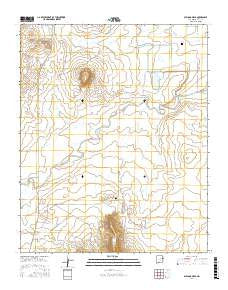
~ Bulldog Mesa NM topo map, 1:24000 scale, 7.5 X 7.5 Minute, 2017
Bulldog Mesa, New Mexico, USGS topographic map dated 2017.
Includes geographic coordinates (latitude and longitude). This topographic map is suitable for hiking, camping, and exploring, or framing it as a wall map.
Printed on-demand using high resolution imagery, on heavy weight and acid free paper, or alternatively on a variety of synthetic materials.
Topos available on paper, Waterproof, Poly, or Tyvek. Usually shipping rolled, unless combined with other folded maps in one order.
- Product Number: USGS-8651528
- Free digital map download (high-resolution, GeoPDF): Bulldog Mesa, New Mexico (file size: 26 MB)
- Map Size: please refer to the dimensions of the GeoPDF map above
- Weight (paper map): ca. 55 grams
- Map Type: POD USGS Topographic Map
- Map Series: US Topo
- Map Verison: Current
- Cell ID: 6155
- Datum: North American Datum of 1983
- Map Projection: Transverse Mercator
- Map Cell Name: Bulldog Mesa
- Grid size: 7.5 X 7.5 Minute
- Date on map: 2017
- Map Scale: 1:24000
- Geographical region: New Mexico, United States
Neighboring Maps:
All neighboring USGS topo maps are available for sale online at a variety of scales.
Spatial coverage:
Topo map Bulldog Mesa, New Mexico, covers the geographical area associated the following places:
- Bulldog Mesa - 05122 Water Well - Fife Ranch - 05142 Water Well - 05116 Water Well - 05113 Water Well - 05149 Water Well - Farmer Ranch - 05114 Water Well - 05136 Water Well - Regulator Reservoir Number 2 - Apodaca Cemetery - Apodaca Creek - 05111 Water Well - Garcia Creek - Owens Ranch - 05134 Water Well - Newhome Cemetery - Dennis Ranch - 10105 Water Well - Stallard Ranch - Fifie - 05115 Water Well - 05135 Water Well - 05073 Water Well - Spikes Creek - 05133 Water Well - Charco Creek - Parker Ranch - 05151 Water Well - 05141 Water Well
- Map Area ID: AREA35.12535-103.75-103.625
- Northwest corner Lat/Long code: USGSNW35.125-103.75
- Northeast corner Lat/Long code: USGSNE35.125-103.625
- Southwest corner Lat/Long code: USGSSW35-103.75
- Southeast corner Lat/Long code: USGSSE35-103.625
- Northern map edge Latitude: 35.125
- Southern map edge Latitude: 35
- Western map edge Longitude: -103.75
- Eastern map edge Longitude: -103.625


