
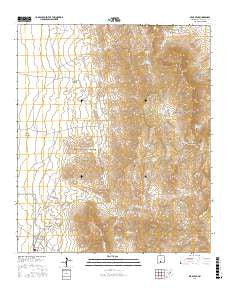
~ Bear Peak NM topo map, 1:24000 scale, 7.5 X 7.5 Minute, 2017
Bear Peak, New Mexico, USGS topographic map dated 2017.
Includes geographic coordinates (latitude and longitude). This topographic map is suitable for hiking, camping, and exploring, or framing it as a wall map.
Printed on-demand using high resolution imagery, on heavy weight and acid free paper, or alternatively on a variety of synthetic materials.
Topos available on paper, Waterproof, Poly, or Tyvek. Usually shipping rolled, unless combined with other folded maps in one order.
- Product Number: USGS-8639942
- Free digital map download (high-resolution, GeoPDF): Bear Peak, New Mexico (file size: 18 MB)
- Map Size: please refer to the dimensions of the GeoPDF map above
- Weight (paper map): ca. 55 grams
- Map Type: POD USGS Topographic Map
- Map Series: US Topo
- Map Verison: Current
- Cell ID: 2841
- Datum: North American Datum of 1983
- Map Projection: Transverse Mercator
- Map Cell Name: Bear Peak
- Grid size: 7.5 X 7.5 Minute
- Date on map: 2017
- Map Scale: 1:24000
- Geographical region: New Mexico, United States
Neighboring Maps:
All neighboring USGS topo maps are available for sale online at a variety of scales.
Spatial coverage:
Topo map Bear Peak, New Mexico, covers the geographical area associated the following places:
- Gardner Spring - Ragged Tank Flat - Ash Spring - Quartz Mountain - Gravelly Ridges Artificial Revegetation Plot - White Sands Test Facility - Burke Spring - Horse Tank - White Sands Division - Salt Canyon Spring - Stinking Spring - New Well - Mountain Tank - Yarbrough Reservoir - Davis Well - West Cottonwood Well - Big Meadow - Little Wells - Big Meadow Tank - Little San Nicholas Canyon - Big Brushy Mountain - Bear Peak - Cox Canyon - Peoria Tank - Rock House Spring - Johnson Space Center White Sands Test Facility Fire Department - East Cottonwood Spring - White Sands Missile Range - Middle Tank - Divide Tanks - Davis Tank - Lion Den Canyon - Love Ranch Headquarters - Salt Canyon - West Cottonwood Spring - Salinas Spring - San Nicholas Spring - Upper Well - Burro Spring
- Map Area ID: AREA32.62532.5-106.625-106.5
- Northwest corner Lat/Long code: USGSNW32.625-106.625
- Northeast corner Lat/Long code: USGSNE32.625-106.5
- Southwest corner Lat/Long code: USGSSW32.5-106.625
- Southeast corner Lat/Long code: USGSSE32.5-106.5
- Northern map edge Latitude: 32.625
- Southern map edge Latitude: 32.5
- Western map edge Longitude: -106.625
- Eastern map edge Longitude: -106.5


