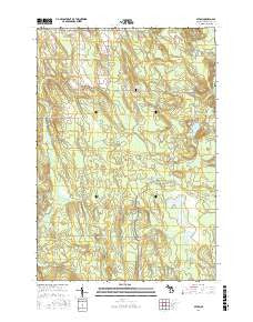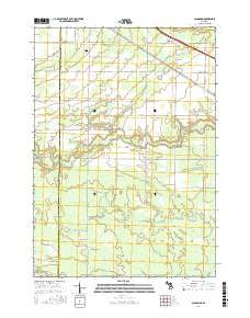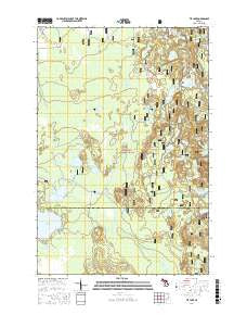
~ Tie Lake MI topo map, 1:24000 scale, 7.5 X 7.5 Minute, Current, 2017
Tie Lake, Michigan, USGS topographic map dated 2017.
Includes geographic coordinates (latitude and longitude). This topographic map is suitable for hiking, camping, and exploring, or framing it as a wall map.
Printed on-demand using high resolution imagery, on heavy weight and acid free paper, or alternatively on a variety of synthetic materials.
Topos available on paper, Waterproof, Poly, or Tyvek. Usually shipping rolled, unless combined with other folded maps in one order.
- Product Number: USGS-8620541
- Free digital map download (high-resolution, GeoPDF): Tie Lake, Michigan (file size: 28 MB)
- Map Size: please refer to the dimensions of the GeoPDF map above
- Weight (paper map): ca. 55 grams
- Map Type: POD USGS Topographic Map
- Map Series: US Topo
- Map Verison: Current
- Cell ID: 45079
- Datum: North American Datum of 1983
- Map Projection: Transverse Mercator
- Map Cell Name: Tie Lake
- Grid size: 7.5 X 7.5 Minute
- Date on map: 2017
- Map Scale: 1:24000
- Geographical region: Michigan, United States
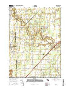
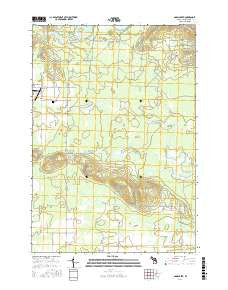
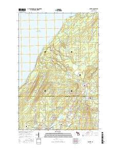
Neighboring Maps:
All neighboring USGS topo maps are available for sale online at a variety of scales.
Spatial coverage:
Topo map Tie Lake, Michigan, covers the geographical area associated the following places:
- Scout Lake - Squaw Ponds - Skeels Lake - McComb Lake - Pan Lake - Slowfoot Lake - Fish Lake - Rock Lake - Snipe Lake - Muskrat Lake - Cluster Lakes - Squaw Lake - Lion Lake - Round Lake - West Branch Lake - West Branch Sturgeon River - Bar Lake - Baldy Lake - Dam Lake - Hammond Lake - Turtle Lake - Camp Red Buck - Skeels Pond - Temple Lake - Hike Lake - Man Lake - Tie Lake - Camp R Creek - Tie Hill Lookout Tower - Crow Lake - Jones Lake - Irwin Lake - Mink Lake - Council Lake - Blue Lake - Hidden Lake - Squaw Creek - Carp Lake - Connor Lake - Red Jack Lake - Wide Water Campground - Camp Red Buck - Cranberry Lake
- Map Area ID: AREA46.2546.125-86.75-86.625
- Northwest corner Lat/Long code: USGSNW46.25-86.75
- Northeast corner Lat/Long code: USGSNE46.25-86.625
- Southwest corner Lat/Long code: USGSSW46.125-86.75
- Southeast corner Lat/Long code: USGSSE46.125-86.625
- Northern map edge Latitude: 46.25
- Southern map edge Latitude: 46.125
- Western map edge Longitude: -86.75
- Eastern map edge Longitude: -86.625