
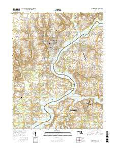
~ Chestertown MD topo map, 1:24000 scale, 7.5 X 7.5 Minute, 2017
Chestertown, Maryland, USGS topographic map dated 2017.
Includes geographic coordinates (latitude and longitude). This topographic map is suitable for hiking, camping, and exploring, or framing it as a wall map.
Printed on-demand using high resolution imagery, on heavy weight and acid free paper, or alternatively on a variety of synthetic materials.
Topos available on paper, Waterproof, Poly, or Tyvek. Usually shipping rolled, unless combined with other folded maps in one order.
- Product Number: USGS-8619438
- Free digital map download (high-resolution, GeoPDF): Chestertown, Maryland (file size: 24 MB)
- Map Size: please refer to the dimensions of the GeoPDF map above
- Weight (paper map): ca. 55 grams
- Map Type: POD USGS Topographic Map
- Map Series: US Topo
- Map Verison: Current
- Cell ID: 8431
- Datum: North American Datum of 1983
- Map Projection: Transverse Mercator
- Map Cell Name: Chestertown
- Grid size: 7.5 X 7.5 Minute
- Date on map: 2017
- Map Scale: 1:24000
- Geographical region: Maryland, United States
Neighboring Maps:
All neighboring USGS topo maps are available for sale online at a variety of scales.
Spatial coverage:
Topo map Chestertown, Maryland, covers the geographical area associated the following places:
- River Edge - Chester Harbor - Washington Park - The Grove - Quaker Neck Landing - Orchard Hill - Fannells Meadow - Mile Tree Village - Royston Shores - Reba L Anthony Estates - Southeast Landing - Langford Acres - Riverview - Coventry Farms - Pomona - Kings Court - Calvert Heights - Amberly Trailer Park - Old Town - Pear Tree Point - Morganec Village - Chestertown - Heron Point - Crestview - Kennersley - Chesmar - Primrose Garth - Lees Corner - Johnsontown - Catlin (historical) - Heather Heights - Rolphs - Wilmers - Foxley Manor - Harrisburg (historical) - Kingstown - Kings Town Manor - Piney Grove
- Map Area ID: AREA39.2539.125-76.125-76
- Northwest corner Lat/Long code: USGSNW39.25-76.125
- Northeast corner Lat/Long code: USGSNE39.25-76
- Southwest corner Lat/Long code: USGSSW39.125-76.125
- Southeast corner Lat/Long code: USGSSE39.125-76
- Northern map edge Latitude: 39.25
- Southern map edge Latitude: 39.125
- Western map edge Longitude: -76.125
- Eastern map edge Longitude: -76


