
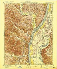
~ Kimmswick MO topo map, 1:62500 scale, 15 X 15 Minute, Historical, 1916
Kimmswick, Missouri, USGS topographic map dated 1916.
Includes geographic coordinates (latitude and longitude). This topographic map is suitable for hiking, camping, and exploring, or framing it as a wall map.
Printed on-demand using high resolution imagery, on heavy weight and acid free paper, or alternatively on a variety of synthetic materials.
Topos available on paper, Waterproof, Poly, or Tyvek. Usually shipping rolled, unless combined with other folded maps in one order.
- Product Number: USGS-8618504
- Free digital map download (high-resolution, GeoPDF): Kimmswick, Missouri (file size: 10 MB)
- Map Size: please refer to the dimensions of the GeoPDF map above
- Weight (paper map): ca. 55 grams
- Map Type: POD USGS Topographic Map
- Map Series: HTMC
- Map Verison: Historical
- Cell ID: 56192
- Scan ID: 325006
- Woodland Tint: Yes
- Survey Year: 1914
- Datum: Unstated
- Map Projection: Unstated
- Map published by United States Geological Survey
- Map Language: English
- Scanner Resolution: 600 dpi
- Map Cell Name: Kimmswick
- Grid size: 15 X 15 Minute
- Date on map: 1916
- Map Scale: 1:62500
- Geographical region: Missouri, United States
Neighboring Maps:
All neighboring USGS topo maps are available for sale online at a variety of scales.
Spatial coverage:
Topo map Kimmswick, Missouri, covers the geographical area associated the following places:
- Seckman - Horine - Fountain - Mattese - Arnold - Munsons - Merrimac - Byers - Lakeside (historical) - Barnhart - Sunnyside - Monroe City - White House - Woodville (historical) - Antonia - Flamm City - Point (historical) - Bushburg - Oakville - Maxville - Valmeyer - Fountain Gap - Murphy - Pevely - Koch (historical) - Rock Creek - Imperial - Paulina Hills - Beck - Wickes - Warnock - Jefferson Heights - Harrisonville - Sulphur Springs - Riverside - Spring Forest - Cliff Cave - Kimmswick - Kise Crossing - Jarvis - Herculaneum - Ten Brook - Engle (historical)
- Map Area ID: AREA38.538.25-90.5-90.25
- Northwest corner Lat/Long code: USGSNW38.5-90.5
- Northeast corner Lat/Long code: USGSNE38.5-90.25
- Southwest corner Lat/Long code: USGSSW38.25-90.5
- Southeast corner Lat/Long code: USGSSE38.25-90.25
- Northern map edge Latitude: 38.5
- Southern map edge Latitude: 38.25
- Western map edge Longitude: -90.5
- Eastern map edge Longitude: -90.25


