
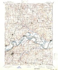
~ Independence MO topo map, 1:125000 scale, 30 X 30 Minute, Historical, 1894, updated 1941
Independence, Missouri, USGS topographic map dated 1894.
Includes geographic coordinates (latitude and longitude). This topographic map is suitable for hiking, camping, and exploring, or framing it as a wall map.
Printed on-demand using high resolution imagery, on heavy weight and acid free paper, or alternatively on a variety of synthetic materials.
Topos available on paper, Waterproof, Poly, or Tyvek. Usually shipping rolled, unless combined with other folded maps in one order.
- Product Number: USGS-8618488
- Free digital map download (high-resolution, GeoPDF): Independence, Missouri (file size: 7 MB)
- Map Size: please refer to the dimensions of the GeoPDF map above
- Weight (paper map): ca. 55 grams
- Map Type: POD USGS Topographic Map
- Map Series: HTMC
- Map Verison: Historical
- Cell ID: 65731
- Scan ID: 325473
- Imprint Year: 1941
- Survey Year: 1887
- Datum: Unstated
- Map Projection: Polyconic
- Map published by United States Geological Survey
- Map Language: English
- Scanner Resolution: 600 dpi
- Map Cell Name: Independence
- Grid size: 30 X 30 Minute
- Date on map: 1894
- Map Scale: 1:125000
- Geographical region: Missouri, United States
Neighboring Maps:
All neighboring USGS topo maps are available for sale online at a variety of scales.
Spatial coverage:
Topo map Independence, Missouri, covers the geographical area associated the following places:
- Cement City - White Hall Fields - Sugar Creek - Winner - Fleming - Randolph - Lawson - East Kansas City - Claycomo - Pleasant Valley - Knoxville - Englewood - Sibley - Buckner - Liberty - Kearney - Eton - Napoleon - Prathersville - Lake Tapawingo - Mount Washington - Excelsior Estates - Waterloo - Golf Hill - Holt - Camden - Grain Valley - Orrick - Elmira Camp - Chandler - Birmingham - Selsa - Bates City - Courtney - Levasy - Blue Mills - Lake City - Minneville - Centropolis - Rock Creek Junction - Crystal Lakes - Vibbard - Air Line Junction - Hiler - East Independence - Elkhorn - Missouri City - Athol - Bristol - Ectonville - Homestead - Miltondale - Maywood - River Bend - Pink Hill - Coopers - New Garden - Cobbler - Rayville - Excelsior Springs - Claysville - Clevenger - Albany - Independence - Haynesville - Saint Cloud - Blue Springs - Ripley - Liberty Landing (historical) - Fairmount - Ravena Gardens - Floyd - Oak Grove - Stockdale - Chick (historical) - Cooleys (historical) - Arley - Greenville - Adams - Crescent Lake - Excelsior Springs Junction - Glenaire - Swanwick - Raytown - Sandals - Camden Junction - Lilly - Mosby - Wood Heights - Roosterville - Converse - South Liberty - Atherton
- Map Area ID: AREA39.539-94.5-94
- Northwest corner Lat/Long code: USGSNW39.5-94.5
- Northeast corner Lat/Long code: USGSNE39.5-94
- Southwest corner Lat/Long code: USGSSW39-94.5
- Southeast corner Lat/Long code: USGSSE39-94
- Northern map edge Latitude: 39.5
- Southern map edge Latitude: 39
- Western map edge Longitude: -94.5
- Eastern map edge Longitude: -94


