
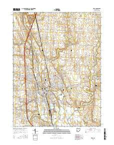
~ Troy OH topo map, 1:24000 scale, 7.5 X 7.5 Minute, 2016
Troy, Ohio, USGS topographic map dated 2016.
Includes geographic coordinates (latitude and longitude). This topographic map is suitable for hiking, camping, and exploring, or framing it as a wall map.
Printed on-demand using high resolution imagery, on heavy weight and acid free paper, or alternatively on a variety of synthetic materials.
Topos available on paper, Waterproof, Poly, or Tyvek. Usually shipping rolled, unless combined with other folded maps in one order.
- Product Number: USGS-8591692
- Free digital map download (high-resolution, GeoPDF): Troy, Ohio (file size: 25 MB)
- Map Size: please refer to the dimensions of the GeoPDF map above
- Weight (paper map): ca. 55 grams
- Map Type: POD USGS Topographic Map
- Map Series: US Topo
- Map Verison: Current
- Cell ID: 45766
- Datum: North American Datum of 1983
- Map Projection: Transverse Mercator
- Map Cell Name: Troy
- Grid size: 7.5 X 7.5 Minute
- Date on map: 2016
- Map Scale: 1:24000
- Geographical region: Ohio, United States
Neighboring Maps:
All neighboring USGS topo maps are available for sale online at a variety of scales.
Spatial coverage:
Topo map Troy, Ohio, covers the geographical area associated the following places:
- Midway - Troy - Maplecrest - Broad Acres - Nottingham - Cobblestone Pointe - Southview Estates - Laine Trailer Park - Staunton - Cloverdale - Windridge Place - Hunters Run - Edgehill - Lazy River Mobile Home Park - Ridgewood Colony - Westhaven - Westbrook - Willowpoint - Meadowlawn - Laurel Creek - Northbrook - Oakmont Creek - Hylands - Southbrook - Sherwood Manor - Twin Lakes (historical) - Ridgewood - Premwood - Heritage Hill - Hawks Nest - Stony Ridge - Conwood Estates - Culbertson Heights - Arbar Acres - Hunters Ridge - Westridge - Halifax - Hawk Cove - Brook Park North - Stanfield Place - Eldean - Casstown - Farrington - Meadowrun - Woodlawn - Park Place - Pleasant View - Northfield - Nottinghill - Brookside - Westlake Village - Hilltop Manor
- Map Area ID: AREA40.12540-84.25-84.125
- Northwest corner Lat/Long code: USGSNW40.125-84.25
- Northeast corner Lat/Long code: USGSNE40.125-84.125
- Southwest corner Lat/Long code: USGSSW40-84.25
- Southeast corner Lat/Long code: USGSSE40-84.125
- Northern map edge Latitude: 40.125
- Southern map edge Latitude: 40
- Western map edge Longitude: -84.25
- Eastern map edge Longitude: -84.125


