
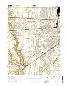
~ Galloway OH topo map, 1:24000 scale, 7.5 X 7.5 Minute, 2016
Galloway, Ohio, USGS topographic map dated 2016.
Includes geographic coordinates (latitude and longitude). This topographic map is suitable for hiking, camping, and exploring, or framing it as a wall map.
Printed on-demand using high resolution imagery, on heavy weight and acid free paper, or alternatively on a variety of synthetic materials.
Topos available on paper, Waterproof, Poly, or Tyvek. Usually shipping rolled, unless combined with other folded maps in one order.
- Product Number: USGS-8575528
- Free digital map download (high-resolution, GeoPDF): Galloway, Ohio (file size: 26 MB)
- Map Size: please refer to the dimensions of the GeoPDF map above
- Weight (paper map): ca. 55 grams
- Map Type: POD USGS Topographic Map
- Map Series: US Topo
- Map Verison: Current
- Cell ID: 16716
- Datum: North American Datum of 1983
- Map Projection: Transverse Mercator
- Map Cell Name: Galloway
- Grid size: 7.5 X 7.5 Minute
- Date on map: 2016
- Map Scale: 1:24000
- Geographical region: Ohio, United States
Neighboring Maps:
All neighboring USGS topo maps are available for sale online at a variety of scales.
Spatial coverage:
Topo map Galloway, Ohio, covers the geographical area associated the following places:
- Summerlyn - Hilliard Commons - Westwoods Village - Epernay - Greene Countrie - Great Oak - Clifton Chase - Halloway - Glenchester - Rome - Post Oak Country Estates - Thornapple Grove - Timberbrook - Village Park - Galloway - Hilliard Green - Sweetwater - Westbend - Coventry - Lake Darby Estates - The Village At Thornapple - Quaker Hill - New Rome - Thornapple Highlands - Laurel Green - The Meadows - Edgewater - Georgesville - Lincoln Village - Lake Darby - Oakmont Village - Alton - Galloway Ridge - Robroy Estates - Westchester
- Map Area ID: AREA4039.875-83.25-83.125
- Northwest corner Lat/Long code: USGSNW40-83.25
- Northeast corner Lat/Long code: USGSNE40-83.125
- Southwest corner Lat/Long code: USGSSW39.875-83.25
- Southeast corner Lat/Long code: USGSSE39.875-83.125
- Northern map edge Latitude: 40
- Southern map edge Latitude: 39.875
- Western map edge Longitude: -83.25
- Eastern map edge Longitude: -83.125


