
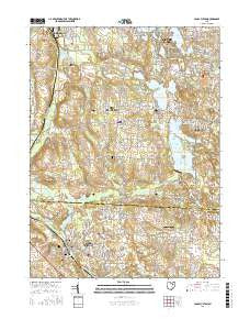
~ Canal Fulton OH topo map, 1:24000 scale, 7.5 X 7.5 Minute, 2016
Canal Fulton, Ohio, USGS topographic map dated 2016.
Includes geographic coordinates (latitude and longitude). This topographic map is suitable for hiking, camping, and exploring, or framing it as a wall map.
Printed on-demand using high resolution imagery, on heavy weight and acid free paper, or alternatively on a variety of synthetic materials.
Topos available on paper, Waterproof, Poly, or Tyvek. Usually shipping rolled, unless combined with other folded maps in one order.
- Product Number: USGS-8574573
- Free digital map download (high-resolution, GeoPDF): Canal Fulton, Ohio (file size: 29 MB)
- Map Size: please refer to the dimensions of the GeoPDF map above
- Weight (paper map): ca. 55 grams
- Map Type: POD USGS Topographic Map
- Map Series: US Topo
- Map Verison: Current
- Cell ID: 7010
- Datum: North American Datum of 1983
- Map Projection: Transverse Mercator
- Map Cell Name: Canal Fulton
- Grid size: 7.5 X 7.5 Minute
- Date on map: 2016
- Map Scale: 1:24000
- Geographical region: Ohio, United States
Neighboring Maps:
All neighboring USGS topo maps are available for sale online at a variety of scales.
Spatial coverage:
Topo map Canal Fulton, Ohio, covers the geographical area associated the following places:
- Deer Valley Estates - Camelot Hills - New Franklin - Solar Estates - Kings Ridge - Nimisila Sunset Heights - Turkeyfoot Heights - Nimisila Mobile Home Park - Rex Hill Mobile Home Park - Aldawood Hills - Tamarack Lake Estates - Ellis Estates - Comet - Hearthstone Estates - Forestwood - Lockwood Corners - Pleasant Hills Estates - Cottage Grove - Canal Fulton - Hillcrest Highlands - Pine Knoll Estates - Sherylton Hills - Tamarack Highlands - West Fulton - Sandy Beach Trailer Park - Country Place Estates - Lakeview - Comet Trailer Park - Withering Heights - Infant of Prague Villa - Brimestone Corners (historical) - Manchester - Robins Trace - Hemlock Green Estates - Merestead Farms
- Map Area ID: AREA4140.875-81.625-81.5
- Northwest corner Lat/Long code: USGSNW41-81.625
- Northeast corner Lat/Long code: USGSNE41-81.5
- Southwest corner Lat/Long code: USGSSW40.875-81.625
- Southeast corner Lat/Long code: USGSSE40.875-81.5
- Northern map edge Latitude: 41
- Southern map edge Latitude: 40.875
- Western map edge Longitude: -81.625
- Eastern map edge Longitude: -81.5


