
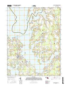
~ Saint Michaels MD topo map, 1:24000 scale, 7.5 X 7.5 Minute, 2016
Saint Michaels, Maryland, USGS topographic map dated 2016.
Includes geographic coordinates (latitude and longitude). This topographic map is suitable for hiking, camping, and exploring, or framing it as a wall map.
Printed on-demand using high resolution imagery, on heavy weight and acid free paper, or alternatively on a variety of synthetic materials.
Topos available on paper, Waterproof, Poly, or Tyvek. Usually shipping rolled, unless combined with other folded maps in one order.
- Product Number: USGS-8564481
- Free digital map download (high-resolution, GeoPDF): Saint Michaels, Maryland (file size: 23 MB)
- Map Size: please refer to the dimensions of the GeoPDF map above
- Weight (paper map): ca. 55 grams
- Map Type: POD USGS Topographic Map
- Map Series: US Topo
- Map Verison: Current
- Cell ID: 39360
- Datum: North American Datum of 1983
- Map Projection: Transverse Mercator
- Map Cell Name: Saint Michaels
- Grid size: 7.5 X 7.5 Minute
- Date on map: 2016
- Map Scale: 1:24000
- Geographical region: Maryland, United States
Neighboring Maps:
All neighboring USGS topo maps are available for sale online at a variety of scales.
Spatial coverage:
Topo map Saint Michaels, Maryland, covers the geographical area associated the following places:
- Aveley - Kirkham - Unionville - Mount Pleasant Farms - Gullwing Villas - Leeds Landing - Swan Villas - Quail Hollow - Madison Place - Doncaster (historical) - Tricfield - Cove View - Thanksgiving - Newcomb - Rio Vista - Rays Point - Tunis Mills - Solitude - Ingleton - Martingham - Arcadia Shores - Copperville - North Bend Estates - Doncaster - Saint Michaels - Riverside - Harper (historical) - Porters Pride - Mulberry Point - Anchorage
- Map Area ID: AREA38.87538.75-76.25-76.125
- Northwest corner Lat/Long code: USGSNW38.875-76.25
- Northeast corner Lat/Long code: USGSNE38.875-76.125
- Southwest corner Lat/Long code: USGSSW38.75-76.25
- Southeast corner Lat/Long code: USGSSE38.75-76.125
- Northern map edge Latitude: 38.875
- Southern map edge Latitude: 38.75
- Western map edge Longitude: -76.25
- Eastern map edge Longitude: -76.125


