
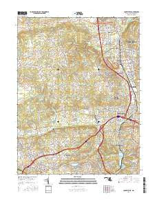
~ Cockeysville MD topo map, 1:24000 scale, 7.5 X 7.5 Minute, 2016
Cockeysville, Maryland, USGS topographic map dated 2016.
Includes geographic coordinates (latitude and longitude). This topographic map is suitable for hiking, camping, and exploring, or framing it as a wall map.
Printed on-demand using high resolution imagery, on heavy weight and acid free paper, or alternatively on a variety of synthetic materials.
Topos available on paper, Waterproof, Poly, or Tyvek. Usually shipping rolled, unless combined with other folded maps in one order.
- Product Number: USGS-8557549
- Free digital map download (high-resolution, GeoPDF): Cockeysville, Maryland (file size: 28 MB)
- Map Size: please refer to the dimensions of the GeoPDF map above
- Weight (paper map): ca. 55 grams
- Map Type: POD USGS Topographic Map
- Map Series: US Topo
- Map Verison: Current
- Cell ID: 9402
- Datum: North American Datum of 1983
- Map Projection: Transverse Mercator
- Map Cell Name: Cockeysville
- Grid size: 7.5 X 7.5 Minute
- Date on map: 2016
- Map Scale: 1:24000
- Geographical region: Maryland, United States
Neighboring Maps:
All neighboring USGS topo maps are available for sale online at a variety of scales.
Spatial coverage:
Topo map Cockeysville, Maryland, covers the geographical area associated the following places:
- Cranwood - Ridgemont - Brightside (historical) - Grey Rock - Greenspring - Fox Ridge Estates - Greengate - Hillside at Seminary - Dembeigh Hill - Halcyon Gate - Greene Tree - The Pines at Deep Run - Brierleigh - Cronhardt - Jonathans Delight - Cooperfield - Long Meadows Estates - Huntspring - Eccleston Valley - Bridleshire - Cedarwood Estates - Shawan - Ranchleigh - Bonnie Ridge - Eccleston - Ruxton Ridge - The Willows of Ruxton - Hickory Meadow - Texas - Riderwood - Padonia - Tufton Ridge Estates - Mays Chapel Village - Brooklandville - Helmsley Court - Cloisters - Knollcrest Manor - Canterbury Estates - Summit Chase - Glenmar - Milestone Manor - Springhill Farms - Chattolanee - Brooklandwood Estates - Bare Hills - Anton Woods - Fields of Stevenson - Woodward - Garrison Farms - Four Winds - Seminary Springs - Broadmeade - Brookwood - Jones Valley - Chapelgate - Rockland - Green Valley North - Greenwood - Greentop Manor - Baronet Woods - Rogers (historical) - Chapel Hill - Dumbarton - Twinridge - Rockland Run - Mayfair - Worthington Ridge - Shawan Valley - Ridervale - Laurelford - Velvet Ridge - Sunset Knoll - Oak Hill - Mays Chapel North - The Oaks at Five Farms - Westwind - Anton North - Fishtown - Wellwood - Hunt Ridge - Mays Chapel - Valleywood - Meadowland - Caveswood - Eden Roc - Cockeysville - York Ridge - Caves Park - Hillstead - Sorrento - Boxer Hill Park - Sugarvale Estates - Sorrento Run - Worthington Greens - Hunt Cup Hill - Timonium Heights - Stevenson - Martins Choice - Valley Stream - The Village
- Map Area ID: AREA39.539.375-76.75-76.625
- Northwest corner Lat/Long code: USGSNW39.5-76.75
- Northeast corner Lat/Long code: USGSNE39.5-76.625
- Southwest corner Lat/Long code: USGSSW39.375-76.75
- Southeast corner Lat/Long code: USGSSE39.375-76.625
- Northern map edge Latitude: 39.5
- Southern map edge Latitude: 39.375
- Western map edge Longitude: -76.75
- Eastern map edge Longitude: -76.625


