
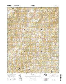
~ Winfield MD topo map, 1:24000 scale, 7.5 X 7.5 Minute, 2016
Winfield, Maryland, USGS topographic map dated 2016.
Includes geographic coordinates (latitude and longitude). This topographic map is suitable for hiking, camping, and exploring, or framing it as a wall map.
Printed on-demand using high resolution imagery, on heavy weight and acid free paper, or alternatively on a variety of synthetic materials.
Topos available on paper, Waterproof, Poly, or Tyvek. Usually shipping rolled, unless combined with other folded maps in one order.
- Product Number: USGS-8557533
- Free digital map download (high-resolution, GeoPDF): Winfield, Maryland (file size: 28 MB)
- Map Size: please refer to the dimensions of the GeoPDF map above
- Weight (paper map): ca. 55 grams
- Map Type: POD USGS Topographic Map
- Map Series: US Topo
- Map Verison: Current
- Cell ID: 49456
- Datum: North American Datum of 1983
- Map Projection: Transverse Mercator
- Map Cell Name: Winfield
- Grid size: 7.5 X 7.5 Minute
- Date on map: 2016
- Map Scale: 1:24000
- Geographical region: Maryland, United States
Neighboring Maps:
All neighboring USGS topo maps are available for sale online at a variety of scales.
Spatial coverage:
Topo map Winfield, Maryland, covers the geographical area associated the following places:
- Eagle Wood Estates - Valley Hill Farms - Day - South Carroll Estates - Ritter - Sanner Estates - Rolling Carroll Estates - Shawns Landing - Red Fox Meadow - Weldon - Flowerwood Estates - Chestnut Oaks - Manahan (historical) - Hazels Woods - Stoney Ridge - River Wood Hills - Villa Tomarchio - Atkins Acres - Sun Valley - Heather Ridge - Piney Run Estates - Ashley Mobile Home Park - Huntfield - Latigo Trails - Benders Heights - Dotsons Ridge - Daisy Meadows - Barrett - Legos Choice - Woodbine Acres - Quail Creek Acres - Kimberly Heights - Stone House Village - Belmar Estates - Stanton Heights - Buffalo Estates - Buckhorn Run - Monks Misery - Fleming Way Estates - Grahams Green Acres - Gilboa - Covers Corner - Dulany Hills - Blankner Hill - Gosnell - Bloom - Taylorsville - Bushey Heights - Winfield - New Horizons - Sun Valley Farms - Mountain Vista - Equestrian Estates - Franklinville - Academy Acres - Gasnell Estates - New Venture Estates - Picketts Corner - Sams Creek - Ray-Mar Estates - Oceola Estates - Gillis Falls Estates - Timbermead - Winfield Heights - Heritage - Daniel - Dales Delight - Cumorah Estates - Watersville Acres - Wild Lake Estates - Ivy Hill Way - Dennings - Braddock Manor West - Glenvue Acres - Rolling Hills - Fischer - Dorsey Hill - Timber Ridge - Tarson Manor - Elbeekay Farms - Village Green Estates - Woodbridge - Raydan Retreat - Poignant Acres - Olde Oak Run - Arthur Ridge - Olde Washington Valley - McHenry Meadows - Dogwood Estates - Winfield Woods - Chases Forest - Buffalo Hills - Airport Acres - White Rock - Dorsey Crossroads - Montclare - Carroll Woods Estates - Braddock Estates - Streamwood
- Map Area ID: AREA39.539.375-77.125-77
- Northwest corner Lat/Long code: USGSNW39.5-77.125
- Northeast corner Lat/Long code: USGSNE39.5-77
- Southwest corner Lat/Long code: USGSSW39.375-77.125
- Southeast corner Lat/Long code: USGSSE39.375-77
- Northern map edge Latitude: 39.5
- Southern map edge Latitude: 39.375
- Western map edge Longitude: -77.125
- Eastern map edge Longitude: -77


