
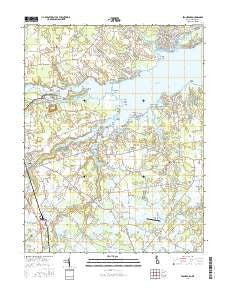
~ Frankford DE topo map, 1:24000 scale, 7.5 X 7.5 Minute, 2016
Frankford, Delaware, USGS topographic map dated 2016.
Includes geographic coordinates (latitude and longitude). This topographic map is suitable for hiking, camping, and exploring, or framing it as a wall map.
Printed on-demand using high resolution imagery, on heavy weight and acid free paper, or alternatively on a variety of synthetic materials.
Topos available on paper, Waterproof, Poly, or Tyvek. Usually shipping rolled, unless combined with other folded maps in one order.
- Product Number: USGS-8538575
- Free digital map download (high-resolution, GeoPDF): Frankford, Delaware (file size: 27 MB)
- Map Size: please refer to the dimensions of the GeoPDF map above
- Weight (paper map): ca. 55 grams
- Map Type: POD USGS Topographic Map
- Map Series: US Topo
- Map Verison: Current
- Cell ID: 16223
- Datum: North American Datum of 1983
- Map Projection: Transverse Mercator
- Map Cell Name: Frankford
- Grid size: 7.5 X 7.5 Minute
- Date on map: 2016
- Map Scale: 1:24000
- Geographical region: Delaware, United States
Neighboring Maps:
All neighboring USGS topo maps are available for sale online at a variety of scales.
Spatial coverage:
Topo map Frankford, Delaware, covers the geographical area associated the following places:
- West Beach - Trinity - Buck Hill Landing - Hillcrest Acres Mobile Home Park - Indian River Acres - Blackwater Village - White House Beach Mobile Home Park - Fairway Villas - River Village II Mobile Home Park - Israel Haul - Driftwood Village Mobile Home Park - Edgewood Manor - Pot Nets West - Warwick Park - Cuelen Acres - Howard Manor - Pine Manor Estates - Bay Colony - Hidden Acres - Oak Orchard - Blackwater Cove - Holly Forest - Omar - Ferry Landing - Pinepoint Mobile Home Park - The Landing - Riverdale - Lazy Lagoon Mobile Home Park - Dagsboro - Thatchers Landing - Irons Lane Landing - Helms Landing - Orchard Manor - Roxford - Sherwood Acres - Clarksville - Frankford - Bayard - Prince George Acres - Bullseye - Harmon - Indiantown Farms - Riverdale - Long Neck - Dogwood Acres Mobile Home Park - Oak Meadows Mobile Home Park - River Village Mobile Home Park - Gull Point - Oak Orchard West Mobile Home Park - Sandy Landing - Warwick - Captains Grant Mobile Home Park - Blackwater Beach - Boyers Village - Blackwater - River Breeze
- Map Area ID: AREA38.62538.5-75.25-75.125
- Northwest corner Lat/Long code: USGSNW38.625-75.25
- Northeast corner Lat/Long code: USGSNE38.625-75.125
- Southwest corner Lat/Long code: USGSSW38.5-75.25
- Southeast corner Lat/Long code: USGSSE38.5-75.125
- Northern map edge Latitude: 38.625
- Southern map edge Latitude: 38.5
- Western map edge Longitude: -75.25
- Eastern map edge Longitude: -75.125


