
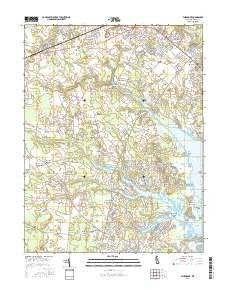
~ Fairmount DE topo map, 1:24000 scale, 7.5 X 7.5 Minute, 2016
Fairmount, Delaware, USGS topographic map dated 2016.
Includes geographic coordinates (latitude and longitude). This topographic map is suitable for hiking, camping, and exploring, or framing it as a wall map.
Printed on-demand using high resolution imagery, on heavy weight and acid free paper, or alternatively on a variety of synthetic materials.
Topos available on paper, Waterproof, Poly, or Tyvek. Usually shipping rolled, unless combined with other folded maps in one order.
- Product Number: USGS-8538573
- Free digital map download (high-resolution, GeoPDF): Fairmount, Delaware (file size: 28 MB)
- Map Size: please refer to the dimensions of the GeoPDF map above
- Weight (paper map): ca. 55 grams
- Map Type: POD USGS Topographic Map
- Map Series: US Topo
- Map Verison: Current
- Cell ID: 14853
- Datum: North American Datum of 1983
- Map Projection: Transverse Mercator
- Map Cell Name: Fairmount
- Grid size: 7.5 X 7.5 Minute
- Date on map: 2016
- Map Scale: 1:24000
- Geographical region: Delaware, United States
Neighboring Maps:
All neighboring USGS topo maps are available for sale online at a variety of scales.
Spatial coverage:
Topo map Fairmount, Delaware, covers the geographical area associated the following places:
- Angola Crest II Mobile Home Park - Angola Landing - Country Village - John Marsh Landing - Arabian Acres - Enchanted Acres Mobile Home Park - Angola by the Bay - Nanticoke Shores Mobile Home Park - Angola Neck Park Mobile Home Park - The Landing - William Ritter Manor - Bookhammer Landing - Tri-State Mobile Home Park - Sherwood Forest Mobile Home Park - Midway Park Subdivision - Cool Spring Farms Mobile Home Park - Fox Hollow - Pine Water Farm - Robinsonville - Shawns Hideaway Mobile Home Park - Midway - Herring Landing - Conley Chapel Village Mobile Home Park - Long Neck Village Mobile Home Park - Holly Pines Mobile Home Park - Woods Edge - Oak Forest Mobile Home Park - Colonial East Mobile Home Park - Winding Creek Village - Pots Nets North Mobile Home Park - Truitts Midway Development - Fisher Landing - Angola Acres II Mobile Home Park - Beaver Dam Acres - Nassau Park Mobile Home Park - Lingo Estate Mobile Home Park - Sloan Landing - Robinson Landing - Old Landing Woods - Greens Landing - Hollymount - Cool Spring - Sea Farers Village - Bay Shore Hills - Sandy Brae - Holiday Pines - Red Mill Farms - The Woods on Herring Creek - Midway Park - Mallard Point - Webb Landing - Rehoboth Shores Mobile Home Park - Shell Landing - Midway Estates - Marshtown - Goslee Mill - Ben Robins Landing - Leisure Point Mobile Home Park - Hollyville Acres - Danfield Acres - Arbre Park Mobile Home Park - Pine Valley Mobile Home Park - Cozy Cove Mobile Home Park - Bay City Mobile Home Park - Log Cabin Mobile Home Park - Old Landing - Mastens Heights Mobile Home Park - Herring Creek Estates - Long Acres - Breezewood - Carpenters Corner - Sheep Pen Landing - Belltown - Lochwood - Indian Mission - Hollyville - Angola Crest Mobile Home Park - Angola Beach Mobile Home Park - Holiday Pines Mobile Home Park - Five Points - West Bay Park Mobile Home Park - Pine Water Landing - Maplewood - Jimtown - Aspen Meadows - Pinetown - Fairmount - Sea Spray Village - The Plantations - The Willows
- Map Area ID: AREA38.7538.625-75.25-75.125
- Northwest corner Lat/Long code: USGSNW38.75-75.25
- Northeast corner Lat/Long code: USGSNE38.75-75.125
- Southwest corner Lat/Long code: USGSSW38.625-75.25
- Southeast corner Lat/Long code: USGSSE38.625-75.125
- Northern map edge Latitude: 38.75
- Southern map edge Latitude: 38.625
- Western map edge Longitude: -75.25
- Eastern map edge Longitude: -75.125


