
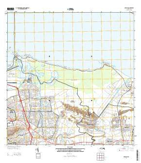
~ Carolina PR topo map, 1:20000 scale, 7.5 X 7.5 Minute, 2013
Carolina, Puerto Rico, USGS topographic map dated 2013.
Includes geographic coordinates (latitude and longitude). This topographic map is suitable for hiking, camping, and exploring, or framing it as a wall map.
Printed on-demand using high resolution imagery, on heavy weight and acid free paper, or alternatively on a variety of synthetic materials.
Topos available on paper, Waterproof, Poly, or Tyvek. Usually shipping rolled, unless combined with other folded maps in one order.
- Product Number: USGS-8537743
- Free digital map download (high-resolution, GeoPDF): Carolina, Puerto Rico (file size: 34 MB)
- Map Size: please refer to the dimensions of the GeoPDF map above
- Weight (paper map): ca. 55 grams
- Map Type: POD USGS Topographic Map
- Map Series: US Topo
- Map Verison: Current
- Cell ID: 7344
- Datum: North American Datum of 1983
- Map Projection: Transverse Mercator
- Map Cell Name: Carolina
- Grid size: 7.5 X 7.5 Minute
- Date on map: 2013
- Map Scale: 1:20000
- Geographical region: Puerto Rico, United States
Neighboring Maps:
All neighboring USGS topo maps are available for sale online at a variety of scales.
Spatial coverage:
Topo map Carolina, Puerto Rico, covers the geographical area associated the following places:
- Monserrate - Loíza Zona Urbana - Turnkey - Castellania Gardens - Canóvanas - Canovanas - Las Cruces - San Isidro Comunidad - Torre de la Sabana - Torres de Carolinas - La Torre - Canóvanas Zona Urbana - Vistamar - Country View - Comunidad Matienzo Cintron - Villa Carolina - Hoyo Mulas - Loíza - Campamento Piñones - Valle Arriba Heights - Carolina - Sabana Abajo - Villa Fontana - Rolling Hills - Villa Astuarias - Quintas de Country Club - Finca Piñones - Buena Vista - Extension Vista Mar - Santa Bárbara - Arenas - Residencial Los Naranjales - Residencial Lagos de Blasina - Martin Gonzales - San Isidro - Palmarenas - Villa Vencia - Colonia San Isidoro (historical) - Santa Bárbara Comunidad - Residencial Jesus T Pinero - El Comandante - Estancias de San Fernando - Rosa María - San Isidro - Colonia Buena Vista (historical) - Sabana Gardens - Villa San Anton - Jardines de Loiza - Piñones - Barrio Colo - Mansiones de Villa Carolina - Jardines de Canovanas - Jardines de Carolina - Jose S Quinones - Jardines de Country Club - Las Mercedes - Vista Mar Marina Oeste - Santa Barbara - Country Club Extension - Carolina Zona Urbana - Palmarejo
- Map Area ID: AREA18.518.375-66-65.875
- Northwest corner Lat/Long code: USGSNW18.5-66
- Northeast corner Lat/Long code: USGSNE18.5-65.875
- Southwest corner Lat/Long code: USGSSW18.375-66
- Southeast corner Lat/Long code: USGSSE18.375-65.875
- Northern map edge Latitude: 18.5
- Southern map edge Latitude: 18.375
- Western map edge Longitude: -66
- Eastern map edge Longitude: -65.875


