
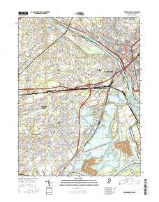
~ Trenton West NJ topo map, 1:24000 scale, 7.5 X 7.5 Minute, 2016
Trenton West, New Jersey, USGS topographic map dated 2016.
Includes geographic coordinates (latitude and longitude). This topographic map is suitable for hiking, camping, and exploring, or framing it as a wall map.
Printed on-demand using high resolution imagery, on heavy weight and acid free paper, or alternatively on a variety of synthetic materials.
Topos available on paper, Waterproof, Poly, or Tyvek. Usually shipping rolled, unless combined with other folded maps in one order.
- Product Number: USGS-8528603
- Free digital map download (high-resolution, GeoPDF): Trenton West, New Jersey (file size: 30 MB)
- Map Size: please refer to the dimensions of the GeoPDF map above
- Weight (paper map): ca. 55 grams
- Map Type: POD USGS Topographic Map
- Map Series: US Topo
- Map Verison: Current
- Cell ID: 45630
- Datum: North American Datum of 1983
- Map Projection: Transverse Mercator
- Map Cell Name: Trenton West
- Grid size: 7.5 X 7.5 Minute
- Date on map: 2016
- Map Scale: 1:24000
- Geographical region: New Jersey, United States
Neighboring Maps:
All neighboring USGS topo maps are available for sale online at a variety of scales.
Spatial coverage:
Topo map Trenton West, New Jersey, covers the geographical area associated the following places:
- Hillcrest - Levittown - Emilie - Goldenridge - Cobalt Ridge - Yardley - Oxford Valley - Quincy Hollow - Will O Wood - Edge Hill - Roelofs - Weber Park - Stonybrook - Glendale - Vermilion Hill - Holly Hill - Violet Wood - Indian Creek - Appletree Hill - Birch Valley - North Park - Elderberry Pond - Prospect Heights - Morrisville - Five Points - Wood - Farmbrook - Prospect Park - Dogwood Hollow - Fairless Hills - Tullytown - Thornridge - Red Cedar Hill - Oaktree Hollow - Greenbrook - Upper Emilie - Whitewood - Pinewood - Crabtree Hollow - Yellowood - Lakeside - Magnolia Hill - Wheat Sheaf - Scammells Corner - Penn Valley - Blue Ridge - Edgely - Fallsington - Dunlap - Mill Creek Falls
- Map Area ID: AREA40.2540.125-74.875-74.75
- Northwest corner Lat/Long code: USGSNW40.25-74.875
- Northeast corner Lat/Long code: USGSNE40.25-74.75
- Southwest corner Lat/Long code: USGSSW40.125-74.875
- Southeast corner Lat/Long code: USGSSE40.125-74.75
- Northern map edge Latitude: 40.25
- Southern map edge Latitude: 40.125
- Western map edge Longitude: -74.875
- Eastern map edge Longitude: -74.75


