
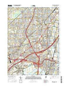
~ Perth Amboy NJ topo map, 1:24000 scale, 7.5 X 7.5 Minute, 2016
Perth Amboy, New Jersey, USGS topographic map dated 2016.
Includes geographic coordinates (latitude and longitude). This topographic map is suitable for hiking, camping, and exploring, or framing it as a wall map.
Printed on-demand using high resolution imagery, on heavy weight and acid free paper, or alternatively on a variety of synthetic materials.
Topos available on paper, Waterproof, Poly, or Tyvek. Usually shipping rolled, unless combined with other folded maps in one order.
- Product Number: USGS-8528575
- Free digital map download (high-resolution, GeoPDF): Perth Amboy, New Jersey (file size: 30 MB)
- Map Size: please refer to the dimensions of the GeoPDF map above
- Weight (paper map): ca. 55 grams
- Map Type: POD USGS Topographic Map
- Map Series: US Topo
- Map Verison: Current
- Cell ID: 34838
- Datum: North American Datum of 1983
- Map Projection: Transverse Mercator
- Map Cell Name: Perth Amboy
- Grid size: 7.5 X 7.5 Minute
- Date on map: 2016
- Map Scale: 1:24000
- Geographical region: New Jersey, United States
Neighboring Maps:
All neighboring USGS topo maps are available for sale online at a variety of scales.
Spatial coverage:
Topo map Perth Amboy, New Jersey, covers the geographical area associated the following places:
- Sewaren - Shore View - Robinvale - Lynn Woodoaks - Colonia - Bonhamtown - Valentine - Barber - Glendinning Homes - Iselin - Port Reading - Menlo Park Terrace - Jefferson Park - Edgar - John J Delaney Homes - Woodbridge Oaks - Harbor Terrace - Woodbridge - Avenel - Perth Amboy - Maurer - Clara Barton - Boynton Beach - Sand Hills - Pumptown - New Dover - Perth Amboy Junction - Nixon - Madison Hill - William Dunlap Homes - Potters - Rahway - Raritan Manor - Phoenix - Menlo Park - Fords - Goodmans Crossing - Metuchen - Keasbey - Hazelton - Hopelawn
- Map Area ID: AREA40.62540.5-74.375-74.25
- Northwest corner Lat/Long code: USGSNW40.625-74.375
- Northeast corner Lat/Long code: USGSNE40.625-74.25
- Southwest corner Lat/Long code: USGSSW40.5-74.375
- Southeast corner Lat/Long code: USGSSE40.5-74.25
- Northern map edge Latitude: 40.625
- Southern map edge Latitude: 40.5
- Western map edge Longitude: -74.375
- Eastern map edge Longitude: -74.25


