
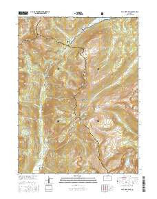
~ Fall River Pass CO topo map, 1:24000 scale, 7.5 X 7.5 Minute, 2016
Fall River Pass, Colorado, USGS topographic map dated 2016.
Includes geographic coordinates (latitude and longitude). This topographic map is suitable for hiking, camping, and exploring, or framing it as a wall map.
Printed on-demand using high resolution imagery, on heavy weight and acid free paper, or alternatively on a variety of synthetic materials.
Topos available on paper, Waterproof, Poly, or Tyvek. Usually shipping rolled, unless combined with other folded maps in one order.
- Product Number: USGS-8440210
- Free digital map download (high-resolution, GeoPDF): Fall River Pass, Colorado (file size: 29 MB)
- Map Size: please refer to the dimensions of the GeoPDF map above
- Weight (paper map): ca. 55 grams
- Map Type: POD USGS Topographic Map
- Map Series: US Topo
- Map Verison: Current
- Cell ID: 14931
- Datum: North American Datum of 1983
- Map Projection: Transverse Mercator
- Map Cell Name: Fall River Pass
- Grid size: 7.5 X 7.5 Minute
- Date on map: 2016
- Map Scale: 1:24000
- Geographical region: Colorado, United States
Neighboring Maps:
All neighboring USGS topo maps are available for sale online at a variety of scales.
Spatial coverage:
Topo map Fall River Pass, Colorado, covers the geographical area associated the following places:
- Box Canyon - Forest Canyon Pass - Little Yellowstone - Doughnut Lake - Specimen Mountain - Lulu Mountain - Sawmill Creek - Thunder Pass - Red Gulch - Iceberg Lake - Timber Creek - Bighorn Lake - Phantom Valley Trading Post - Big Dutch Creek - Arrowhead Lake - Phantom Creek - Middle Dutch Creek - Medicine Bow Curve - Mosquito Creek - Beaver Creek - Little Dutch Creek - Milner Pass Road Camp - Lulu Creek - Lake Irene - Grand Ditch - Squeak Creek - Long Draw Reservoir - Farview Curve - Neota Creek - The Crater - Upper Michigan Ditch - Specimen Creek - Poudre Lake - Sheep Rock - Neota Trailhead - Shipler Park - Hells Hip Pocket - Mount Neota - Lost Creek - Grand View Campground - Fall River Pass - Thunder Pass Trail - Phantom Valley Ranch - La Poudre Pass Trail - Love Lake - Ditch Camp - Lulu City Cemetery - Jackstraw Mountain - Red Mountain Trail - La Poudre Pass Ranger Station - Crater Gulch - Specimen Mountain Trail - Shipler Mountain - Opposition Creek - Lady Creek - Lulu City (historical) - La Poudre Pass - Timber Creek Campground - Thunder Mountain - Skeleton Gulch - Milner Pass - Gore Range Overlook - Hitchings Gulch
- Map Area ID: AREA40.540.375-105.875-105.75
- Northwest corner Lat/Long code: USGSNW40.5-105.875
- Northeast corner Lat/Long code: USGSNE40.5-105.75
- Southwest corner Lat/Long code: USGSSW40.375-105.875
- Southeast corner Lat/Long code: USGSSE40.375-105.75
- Northern map edge Latitude: 40.5
- Southern map edge Latitude: 40.375
- Western map edge Longitude: -105.875
- Eastern map edge Longitude: -105.75


