
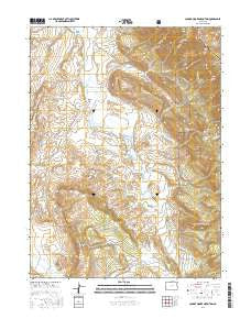
~ Johnny Moore Mountain CO topo map, 1:24000 scale, 7.5 X 7.5 Minute, 2016
Johnny Moore Mountain, Colorado, USGS topographic map dated 2016.
Includes geographic coordinates (latitude and longitude). This topographic map is suitable for hiking, camping, and exploring, or framing it as a wall map.
Printed on-demand using high resolution imagery, on heavy weight and acid free paper, or alternatively on a variety of synthetic materials.
Topos available on paper, Waterproof, Poly, or Tyvek. Usually shipping rolled, unless combined with other folded maps in one order.
- Product Number: USGS-8369741
- Free digital map download (high-resolution, GeoPDF): Johnny Moore Mountain, Colorado (file size: 25 MB)
- Map Size: please refer to the dimensions of the GeoPDF map above
- Weight (paper map): ca. 55 grams
- Map Type: POD USGS Topographic Map
- Map Series: US Topo
- Map Verison: Current
- Cell ID: 22672
- Datum: North American Datum of 1983
- Map Projection: Transverse Mercator
- Map Cell Name: Johnny Moore Mountain
- Grid size: 7.5 X 7.5 Minute
- Date on map: 2016
- Map Scale: 1:24000
- Geographical region: Colorado, United States
Neighboring Maps:
All neighboring USGS topo maps are available for sale online at a variety of scales.
Spatial coverage:
Topo map Johnny Moore Mountain, Colorado, covers the geographical area associated the following places:
- Winscom Mine - Jack Dickens Trail - Freeman Ditch - Rogerson Ranch - Cat Canyon - Phelan Ditch - Spear Ditch - Willow Creek - Muddy Park - Ray Ranch - Canadian Strip Mine - Fernando Ditch - Kelley Ditch - Smith Ditch - Kerr Mine - McNally Creek - Bolton Draw - Carpenter Ditch Number 1 - McKenzie Creek - Kelly Creek - Toledo Ditch - Johnny Moore Mountain - Bush Draw - Gillette Ditch Number 3 - Sudduth Ditch Number 1 - Kenney Ditch - Elk Mountain - Sudduth Ditch Number 5 - Marr Mine - Lang Prospect - Pomroy Ditch Number 2 - Dodge Ranch - Clear Creek - Muddy Creek - Spear and Michigan Highline Ditch - Dale Ditch - Dickens Ranch - Gillette Ditch Number 1 - Mace Ranch - Allen Creek - Marr Mines - Bonafide Ditch Number 2 - Vita Ditch - Troublesome Ditch - Pomroy Ditch - Brown Park - Gillette Ditch Number 2 - Dry Creek - Bonafide Ditch - Kelley Highline and Kermode Ditch Number 2 - Colter Ranch
- Map Area ID: AREA40.7540.625-106.125-106
- Northwest corner Lat/Long code: USGSNW40.75-106.125
- Northeast corner Lat/Long code: USGSNE40.75-106
- Southwest corner Lat/Long code: USGSSW40.625-106.125
- Southeast corner Lat/Long code: USGSSE40.625-106
- Northern map edge Latitude: 40.75
- Southern map edge Latitude: 40.625
- Western map edge Longitude: -106.125
- Eastern map edge Longitude: -106


