
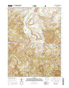
~ Spicer Peak CO topo map, 1:24000 scale, 7.5 X 7.5 Minute, 2016
Spicer Peak, Colorado, USGS topographic map dated 2016.
Includes geographic coordinates (latitude and longitude). This topographic map is suitable for hiking, camping, and exploring, or framing it as a wall map.
Printed on-demand using high resolution imagery, on heavy weight and acid free paper, or alternatively on a variety of synthetic materials.
Topos available on paper, Waterproof, Poly, or Tyvek. Usually shipping rolled, unless combined with other folded maps in one order.
- Product Number: USGS-8367487
- Free digital map download (high-resolution, GeoPDF): Spicer Peak, Colorado (file size: 26 MB)
- Map Size: please refer to the dimensions of the GeoPDF map above
- Weight (paper map): ca. 55 grams
- Map Type: POD USGS Topographic Map
- Map Series: US Topo
- Map Verison: Current
- Cell ID: 42494
- Datum: North American Datum of 1983
- Map Projection: Transverse Mercator
- Map Cell Name: Spicer Peak
- Grid size: 7.5 X 7.5 Minute
- Date on map: 2016
- Map Scale: 1:24000
- Geographical region: Colorado, United States
Neighboring Maps:
All neighboring USGS topo maps are available for sale online at a variety of scales.
Spatial coverage:
Topo map Spicer Peak, Colorado, covers the geographical area associated the following places:
- Coyte Dam - Seymour Ditch Number 2 - West Arapaho Reservoir - Hecla Reservoir - Kidney Lake - West Arapahoe Feeder Ditch Number 2 - Titantic Ditch - South Fork Arapaho Creek - Eureka Ditch - Seymour Dam - Horseshoe Bend Draw - Jordan Ditch - Martin Ditch - West Arapahoe Dam - Ed Van Draw - Seymour Ditch Number 1 - Arapaho Creek - Mexican Reservoir - Seymour Lake - Lawrence Number 1 Ditch - South Arapaho Reservoir - Hecla Dam - West Home Ranch - Ironclad Mountain - Middle Fork Arapaho Creek - Van Valkenburg Reservoir - Indian Creek - Middle Fork Mexican Creek - Larsen Ditch - Murphy Desert Ranch - Spicer - South Fork Mexican Creek - Coyte Reservoir - Waste Ditch - Chas Murphy Ranch - Ninegar Creek - Dennis Hump - Koping Ditch - F P Murphy Ranch - Van Valkenburg Dam - West Arapahoe Feeder Ditch - Arapaho Pass - Spicer Peak - Surprise Ditch - Bailey Ranch - Arapaho Ditch - Mexican Creek Dam - Little Haystack Mountain - Wade Lake - Van Valkenburg Ranch - Experiment Ditch - Arapaho Ditch - Wade Dam
- Map Area ID: AREA40.540.375-106.5-106.375
- Northwest corner Lat/Long code: USGSNW40.5-106.5
- Northeast corner Lat/Long code: USGSNE40.5-106.375
- Southwest corner Lat/Long code: USGSSW40.375-106.5
- Southeast corner Lat/Long code: USGSSE40.375-106.375
- Northern map edge Latitude: 40.5
- Southern map edge Latitude: 40.375
- Western map edge Longitude: -106.5
- Eastern map edge Longitude: -106.375


