
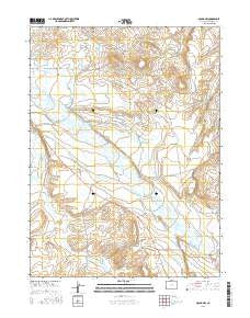
~ Gould NW CO topo map, 1:24000 scale, 7.5 X 7.5 Minute, 2016
Gould NW, Colorado, USGS topographic map dated 2016.
Includes geographic coordinates (latitude and longitude). This topographic map is suitable for hiking, camping, and exploring, or framing it as a wall map.
Printed on-demand using high resolution imagery, on heavy weight and acid free paper, or alternatively on a variety of synthetic materials.
Topos available on paper, Waterproof, Poly, or Tyvek. Usually shipping rolled, unless combined with other folded maps in one order.
- Product Number: USGS-8367461
- Free digital map download (high-resolution, GeoPDF): Gould NW, Colorado (file size: 22 MB)
- Map Size: please refer to the dimensions of the GeoPDF map above
- Weight (paper map): ca. 55 grams
- Map Type: POD USGS Topographic Map
- Map Series: US Topo
- Map Verison: Current
- Cell ID: 17855
- Datum: North American Datum of 1983
- Map Projection: Transverse Mercator
- Map Cell Name: Gould NW
- Grid size: 7.5 X 7.5 Minute
- Date on map: 2016
- Map Scale: 1:24000
- Geographical region: Colorado, United States
Neighboring Maps:
All neighboring USGS topo maps are available for sale online at a variety of scales.
Spatial coverage:
Topo map Gould NW, Colorado, covers the geographical area associated the following places:
- Mathews Eastern Ditch - Kimmons Draw - Edith Ditch - Dike Ditch - Hill and Crouter Ditch - Hugh Griffith Ditch - Curtin Ditch - Terrell Ditch - Conrad Coal Mine - Lower Walden Ditch - Old S C Ditch - Owl Creek - Sudduth Coal Mine - Martin Ditch - Monolith Mine - Paul Ditch Number 2 - Paul Ditch Number 1 - Spring Creek - Capron Mine - Carden Dagle Ditch - Mathews Ditch - Hugh Griffith Ditch Number 2 - Nellie E Ditch - Walden Ditch - Wales Ditch - Dry Fork Michigan River - Sage Hen Creek - Jakey Ditch - Manning Coal Mines - Meadow Creek Ditch - Three Rivers Ranch - Nancy Jane Ditch - Michigan Association Ditch - Meadow Creek - Cleveland Ditch - Mac Farlane Meadows Ditch - Bostwick Ditch
- Map Area ID: AREA40.7540.625-106.25-106.125
- Northwest corner Lat/Long code: USGSNW40.75-106.25
- Northeast corner Lat/Long code: USGSNE40.75-106.125
- Southwest corner Lat/Long code: USGSSW40.625-106.25
- Southeast corner Lat/Long code: USGSSE40.625-106.125
- Northern map edge Latitude: 40.75
- Southern map edge Latitude: 40.625
- Western map edge Longitude: -106.25
- Eastern map edge Longitude: -106.125


