
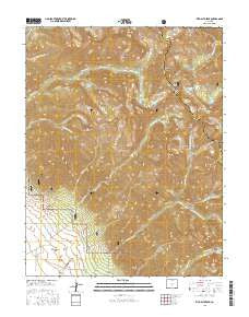
~ Rito Alto Peak CO topo map, 1:24000 scale, 7.5 X 7.5 Minute, 2016
Rito Alto Peak, Colorado, USGS topographic map dated 2016.
Includes geographic coordinates (latitude and longitude). This topographic map is suitable for hiking, camping, and exploring, or framing it as a wall map.
Printed on-demand using high resolution imagery, on heavy weight and acid free paper, or alternatively on a variety of synthetic materials.
Topos available on paper, Waterproof, Poly, or Tyvek. Usually shipping rolled, unless combined with other folded maps in one order.
- Product Number: USGS-8367407
- Free digital map download (high-resolution, GeoPDF): Rito Alto Peak, Colorado (file size: 30 MB)
- Map Size: please refer to the dimensions of the GeoPDF map above
- Weight (paper map): ca. 55 grams
- Map Type: POD USGS Topographic Map
- Map Series: US Topo
- Map Verison: Current
- Cell ID: 38017
- Datum: North American Datum of 1983
- Map Projection: Transverse Mercator
- Map Cell Name: Rito Alto Peak
- Grid size: 7.5 X 7.5 Minute
- Date on map: 2016
- Map Scale: 1:24000
- Geographical region: Colorado, United States
Neighboring Maps:
All neighboring USGS topo maps are available for sale online at a variety of scales.
Spatial coverage:
Topo map Rito Alto Peak, Colorado, covers the geographical area associated the following places:
- Hermit Pass - Stinking Arroyo - Eureka Lake - Rito Alto Peak - Mas Alto Lake - Horseshoe Lake - Lake Fork North Crestone Creek - Gibson Peak - North Crestone Campground - Dimick Gulch - Groundhog Basin - Venable Pass - Kolkman Basin - North Fork North Creston Creek - Rito Alto Trail - Mill Creek - San Isabel Lake - Hutchinson Homestead - Rito Alto Lake - Hermit Lake Trail - Blind Lake - Sangre de Cristo Wilderness - Hermit Lake - Hermit Peak - Loop Trail - Middle Fork North Crestone Creek - Dry Gulch - King Homestead - South Fork Cedar Creek - Hutchinson Homestead - Venable Peak - North Fork Cedar Creek - Elaine Lake - Eureka Mountain
- Map Area ID: AREA38.12538-105.75-105.625
- Northwest corner Lat/Long code: USGSNW38.125-105.75
- Northeast corner Lat/Long code: USGSNE38.125-105.625
- Southwest corner Lat/Long code: USGSSW38-105.75
- Southeast corner Lat/Long code: USGSSE38-105.625
- Northern map edge Latitude: 38.125
- Southern map edge Latitude: 38
- Western map edge Longitude: -105.75
- Eastern map edge Longitude: -105.625


