
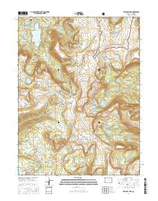
~ Trappers Lake CO topo map, 1:24000 scale, 7.5 X 7.5 Minute, 2016
Trappers Lake, Colorado, USGS topographic map dated 2016.
Includes geographic coordinates (latitude and longitude). This topographic map is suitable for hiking, camping, and exploring, or framing it as a wall map.
Printed on-demand using high resolution imagery, on heavy weight and acid free paper, or alternatively on a variety of synthetic materials.
Topos available on paper, Waterproof, Poly, or Tyvek. Usually shipping rolled, unless combined with other folded maps in one order.
- Product Number: USGS-8367401
- Free digital map download (high-resolution, GeoPDF): Trappers Lake, Colorado (file size: 29 MB)
- Map Size: please refer to the dimensions of the GeoPDF map above
- Weight (paper map): ca. 55 grams
- Map Type: POD USGS Topographic Map
- Map Series: US Topo
- Map Verison: Current
- Cell ID: 45571
- Datum: North American Datum of 1983
- Map Projection: Transverse Mercator
- Map Cell Name: Trappers Lake
- Grid size: 7.5 X 7.5 Minute
- Date on map: 2016
- Map Scale: 1:24000
- Geographical region: Colorado, United States
Neighboring Maps:
All neighboring USGS topo maps are available for sale online at a variety of scales.
Spatial coverage:
Topo map Trappers Lake, Colorado, covers the geographical area associated the following places:
- Scotts Lake Trailhead - Upper Island Lake - Little Marvine Peaks - Sheep Mountain - Cutthroat Campground - Crescent Lake Number 2 - Parvin Lake - Scotts Lake - Crescent Lake Number 1 Dam - Crescent Lake Number 2 Dam - Shepherds Rim Campground - Bucks Campground - Surprise Lake - Crescent Lake Number 1 - Coffin Lake - Trappers Lake Campground - Deer Lake - Fraser Creek - Wall Lake - Shepherd Lake - Crescent Lake - Amphitheatre - Scotts Bay Trailhead - Shingle Lake - Derby Peak - Shingle Peak - Trappers Lake - Rim Lake - Mackinaw Lake - Trapline Campground - Trappers Outlet Trailhead - Bull Lake - Little Trappers Lake - Island Lake - Wall Lake Trailhead - Anderson Lake - Crescent Lake - Mirror Lake
- Map Area ID: AREA4039.875-107.25-107.125
- Northwest corner Lat/Long code: USGSNW40-107.25
- Northeast corner Lat/Long code: USGSNE40-107.125
- Southwest corner Lat/Long code: USGSSW39.875-107.25
- Southeast corner Lat/Long code: USGSSE39.875-107.125
- Northern map edge Latitude: 40
- Southern map edge Latitude: 39.875
- Western map edge Longitude: -107.25
- Eastern map edge Longitude: -107.125


