
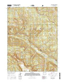
~ Ripple Creek CO topo map, 1:24000 scale, 7.5 X 7.5 Minute, 2016
Ripple Creek, Colorado, USGS topographic map dated 2016.
Includes geographic coordinates (latitude and longitude). This topographic map is suitable for hiking, camping, and exploring, or framing it as a wall map.
Printed on-demand using high resolution imagery, on heavy weight and acid free paper, or alternatively on a variety of synthetic materials.
Topos available on paper, Waterproof, Poly, or Tyvek. Usually shipping rolled, unless combined with other folded maps in one order.
- Product Number: USGS-8367337
- Free digital map download (high-resolution, GeoPDF): Ripple Creek, Colorado (file size: 30 MB)
- Map Size: please refer to the dimensions of the GeoPDF map above
- Weight (paper map): ca. 55 grams
- Map Type: POD USGS Topographic Map
- Map Series: US Topo
- Map Verison: Current
- Cell ID: 38002
- Datum: North American Datum of 1983
- Map Projection: Transverse Mercator
- Map Cell Name: Ripple Creek
- Grid size: 7.5 X 7.5 Minute
- Date on map: 2016
- Map Scale: 1:24000
- Geographical region: Colorado, United States
Neighboring Maps:
All neighboring USGS topo maps are available for sale online at a variety of scales.
Spatial coverage:
Topo map Ripple Creek, Colorado, covers the geographical area associated the following places:
- Snell Park - Big Fish Creek - Lily Pond Park - Deadhorse Creek - Sable Lake - Picket Pin Creek - Lynx Creek - Ripple Creek Pass - Lake of the Woods - Paradise Creek - Mirror Lake - Hauskins Creek - Lily Pond Trailhead - Snell Mountain - Rainbow Lake - Snell Creek - Himes Peak Campground - Sable Point - Boulder Lake - Lost Lakes - Pagoda Trailhead - Lily Pond - Doris Lake - Anderson Reservoir - Big Fish Trailhead - Paradise Lake - Lake of the Woods Dam - Himes Peak - Mirror Creek - Bessies Falls - Ripple Creek - Shamrock Lake - Mirror Lake Trailhead - Picket Pin Park - Bear Creek - Lake of the Woods
- Map Area ID: AREA40.12540-107.375-107.25
- Northwest corner Lat/Long code: USGSNW40.125-107.375
- Northeast corner Lat/Long code: USGSNE40.125-107.25
- Southwest corner Lat/Long code: USGSSW40-107.375
- Southeast corner Lat/Long code: USGSSE40-107.25
- Northern map edge Latitude: 40.125
- Southern map edge Latitude: 40
- Western map edge Longitude: -107.375
- Eastern map edge Longitude: -107.25


