
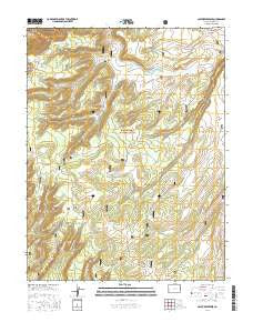
~ Casto Reservoir CO topo map, 1:24000 scale, 7.5 X 7.5 Minute, 2016
Casto Reservoir, Colorado, USGS topographic map dated 2016.
Includes geographic coordinates (latitude and longitude). This topographic map is suitable for hiking, camping, and exploring, or framing it as a wall map.
Printed on-demand using high resolution imagery, on heavy weight and acid free paper, or alternatively on a variety of synthetic materials.
Topos available on paper, Waterproof, Poly, or Tyvek. Usually shipping rolled, unless combined with other folded maps in one order.
- Product Number: USGS-8367181
- Free digital map download (high-resolution, GeoPDF): Casto Reservoir, Colorado (file size: 27 MB)
- Map Size: please refer to the dimensions of the GeoPDF map above
- Weight (paper map): ca. 55 grams
- Map Type: POD USGS Topographic Map
- Map Series: US Topo
- Map Verison: Current
- Cell ID: 7614
- Datum: North American Datum of 1983
- Map Projection: Transverse Mercator
- Map Cell Name: Casto Reservoir
- Grid size: 7.5 X 7.5 Minute
- Date on map: 2016
- Map Scale: 1:24000
- Geographical region: Colorado, United States
Neighboring Maps:
All neighboring USGS topo maps are available for sale online at a variety of scales.
Spatial coverage:
Topo map Casto Reservoir, Colorado, covers the geographical area associated the following places:
- Massey Trail - Leonards Ridge - Black Camp - Divide Forks Trail - Basin Trail - Beaver Creek - Casto Dam - Corral Fork Little Creek - Dead Horse Pasture - Smith Point - Little Creek - Massey Bench - Craig Number 2 Dam - Little Bear Lake - Ute Creek Trail - Divide Forks Campground - Cold Springs Ranger Station - Casto Reservoir - Big Creek Ranch - Big Creek - Big Creek Reservoir - Rim Trail - Cabin Trail - Bug Point - Hungry Gulch - Telephone Trail - Smith Creek
- Map Area ID: AREA38.7538.625-108.75-108.625
- Northwest corner Lat/Long code: USGSNW38.75-108.75
- Northeast corner Lat/Long code: USGSNE38.75-108.625
- Southwest corner Lat/Long code: USGSSW38.625-108.75
- Southeast corner Lat/Long code: USGSSE38.625-108.625
- Northern map edge Latitude: 38.75
- Southern map edge Latitude: 38.625
- Western map edge Longitude: -108.75
- Eastern map edge Longitude: -108.625


