
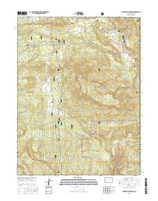
~ Electric Mountain CO topo map, 1:24000 scale, 7.5 X 7.5 Minute, 2016
Electric Mountain, Colorado, USGS topographic map dated 2016.
Includes geographic coordinates (latitude and longitude). This topographic map is suitable for hiking, camping, and exploring, or framing it as a wall map.
Printed on-demand using high resolution imagery, on heavy weight and acid free paper, or alternatively on a variety of synthetic materials.
Topos available on paper, Waterproof, Poly, or Tyvek. Usually shipping rolled, unless combined with other folded maps in one order.
- Product Number: USGS-8365432
- Free digital map download (high-resolution, GeoPDF): Electric Mountain, Colorado (file size: 29 MB)
- Map Size: please refer to the dimensions of the GeoPDF map above
- Weight (paper map): ca. 55 grams
- Map Type: POD USGS Topographic Map
- Map Series: US Topo
- Map Verison: Current
- Cell ID: 13894
- Datum: North American Datum of 1983
- Map Projection: Transverse Mercator
- Map Cell Name: Electric Mountain
- Grid size: 7.5 X 7.5 Minute
- Date on map: 2016
- Map Scale: 1:24000
- Geographical region: Colorado, United States
Neighboring Maps:
All neighboring USGS topo maps are available for sale online at a variety of scales.
Spatial coverage:
Topo map Electric Mountain, Colorado, covers the geographical area associated the following places:
- Cottonwood Creek - Lone Pine Creek - Big Alder Creek - Chimney Rocks - Morman Creek - West Hubbard Creek - Poison Park - Little Alder Creek - Middle Hubbard Creek - Fawn Creek - Columbine Ditch Nuber Two - Little Dyke Creek - Beaver Creek - Main Hubbard Creek - Grouse Spring - Norells Bell Ranch - Bulk Park Ditch - Branch of Bee Creek - Columbine Ditch Number Five - Flying M Ranch - Wolf Creek - Columbine Ditch Nuber One - Trail Creek - Hubbard Park - Lombard Slides - Electric Mountain - Pilot Creek - Twin Spruce Ditch - Terror Trail - Cow Creek - Willow Creek - Elk Creek - Columbine Ditch Number Three - West Muddy Ranger Station - Molly Group Mine - Dyke Ditch Number Two - Slide Creek - Columbine Ranch
- Map Area ID: AREA39.12539-107.625-107.5
- Northwest corner Lat/Long code: USGSNW39.125-107.625
- Northeast corner Lat/Long code: USGSNE39.125-107.5
- Southwest corner Lat/Long code: USGSSW39-107.625
- Southeast corner Lat/Long code: USGSSE39-107.5
- Northern map edge Latitude: 39.125
- Southern map edge Latitude: 39
- Western map edge Longitude: -107.625
- Eastern map edge Longitude: -107.5


