
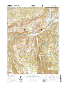
~ Big Beaver Reservoir CO topo map, 1:24000 scale, 7.5 X 7.5 Minute, 2016
Big Beaver Reservoir, Colorado, USGS topographic map dated 2016.
Includes geographic coordinates (latitude and longitude). This topographic map is suitable for hiking, camping, and exploring, or framing it as a wall map.
Printed on-demand using high resolution imagery, on heavy weight and acid free paper, or alternatively on a variety of synthetic materials.
Topos available on paper, Waterproof, Poly, or Tyvek. Usually shipping rolled, unless combined with other folded maps in one order.
- Product Number: USGS-8365402
- Free digital map download (high-resolution, GeoPDF): Big Beaver Reservoir, Colorado (file size: 28 MB)
- Map Size: please refer to the dimensions of the GeoPDF map above
- Weight (paper map): ca. 55 grams
- Map Type: POD USGS Topographic Map
- Map Series: US Topo
- Map Verison: Current
- Cell ID: 3631
- Datum: North American Datum of 1983
- Map Projection: Transverse Mercator
- Map Cell Name: Big Beaver Reservoir
- Grid size: 7.5 X 7.5 Minute
- Date on map: 2016
- Map Scale: 1:24000
- Geographical region: Colorado, United States
Neighboring Maps:
All neighboring USGS topo maps are available for sale online at a variety of scales.
Spatial coverage:
Topo map Big Beaver Reservoir, Colorado, covers the geographical area associated the following places:
- Sawmill Creek - Big Ridge - Gregor Dam - Daum Draw - North Elk Creek - Deadman Gulch - Dobbs Reservoir - Beaver Lake - Marcott Ditch - Bel-aire Rearing Station - Gregor Reservoir - Lake Avery - Beaver Lake Dam - Gilley Lake - Burro Mountain Lake - Shadow Lake - Vaughn Creek - Stump Lake - North Fork White River - Greenstreet Creek - North Elk Cow Camp - Big Beaver Dam - Warner Point - South Fork White River - Russell Camp - Seventh Lake - Cabin Lake - Beaver Lake Reservoir - Big Beaver Reservoir - Whiskey Gulch - Big Beaver Creek
- Map Area ID: AREA4039.875-107.75-107.625
- Northwest corner Lat/Long code: USGSNW40-107.75
- Northeast corner Lat/Long code: USGSNE40-107.625
- Southwest corner Lat/Long code: USGSSW39.875-107.75
- Southeast corner Lat/Long code: USGSSE39.875-107.625
- Northern map edge Latitude: 40
- Southern map edge Latitude: 39.875
- Western map edge Longitude: -107.75
- Eastern map edge Longitude: -107.625


