
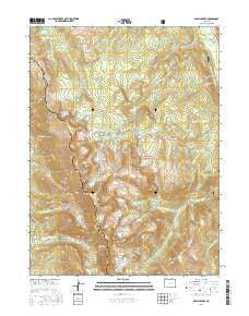
~ Rawah Lakes CO topo map, 1:24000 scale, 7.5 X 7.5 Minute, 2016
Rawah Lakes, Colorado, USGS topographic map dated 2016.
Includes geographic coordinates (latitude and longitude). This topographic map is suitable for hiking, camping, and exploring, or framing it as a wall map.
Printed on-demand using high resolution imagery, on heavy weight and acid free paper, or alternatively on a variety of synthetic materials.
Topos available on paper, Waterproof, Poly, or Tyvek. Usually shipping rolled, unless combined with other folded maps in one order.
- Product Number: USGS-8364496
- Free digital map download (high-resolution, GeoPDF): Rawah Lakes, Colorado (file size: 28 MB)
- Map Size: please refer to the dimensions of the GeoPDF map above
- Weight (paper map): ca. 55 grams
- Map Type: POD USGS Topographic Map
- Map Series: US Topo
- Map Verison: Current
- Cell ID: 71348
- Datum: North American Datum of 1983
- Map Projection: Transverse Mercator
- Map Cell Name: Rawah Lakes
- Grid size: 7.5 X 7.5 Minute
- Date on map: 2016
- Map Scale: 1:24000
- Geographical region: Colorado, United States
Neighboring Maps:
All neighboring USGS topo maps are available for sale online at a variety of scales.
Spatial coverage:
Topo map Rawah Lakes, Colorado, covers the geographical area associated the following places:
- Iceberg Lake - West Branch Trail - Kelly Lake - South Rawah Peak - West Branch Laramie River - Camp Lake Trail - North Fork West Branch Laramie River - Rawah Lakes - Porter Creek - Rawah Wilderness - Bench Lake - Grassy Pass - Rawah Lake Number 3 - North Fork Trail - Big Rainbow Lake - Camp Creek - Link Trail - Lower Twin Lake - Sheep Mountain - South Fork Rapid Creek - Rawah Bog - Little Rainbow Lake - Twin Crater Lakes - Upper Sandbar Lake - North Fork Rapid Creek - Camp Lake - Rockhole Lake - Rawah Lake Number 1 - North Fork Rawah Creek - Upper Camp Lake - North Rawah Peak - Half Way Creek - Sugarbowl Lake - Rawah Lake Number 4 - Carey Lake - Upper Twin Lake - McIntyre Lake - Lower Sandbar Lake - McIntyre Lake Trail - Island Lake - Lost Lake - Rawah Ranch - Rawah Trail - Rawah Lake Number 2 - Clear Lake
- Map Area ID: AREA40.7540.625-106-105.875
- Northwest corner Lat/Long code: USGSNW40.75-106
- Northeast corner Lat/Long code: USGSNE40.75-105.875
- Southwest corner Lat/Long code: USGSSW40.625-106
- Southeast corner Lat/Long code: USGSSE40.625-105.875
- Northern map edge Latitude: 40.75
- Southern map edge Latitude: 40.625
- Western map edge Longitude: -106
- Eastern map edge Longitude: -105.875


