
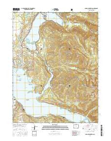
~ Shadow Mountain CO topo map, 1:24000 scale, 7.5 X 7.5 Minute, 2016
Shadow Mountain, Colorado, USGS topographic map dated 2016.
Includes geographic coordinates (latitude and longitude). This topographic map is suitable for hiking, camping, and exploring, or framing it as a wall map.
Printed on-demand using high resolution imagery, on heavy weight and acid free paper, or alternatively on a variety of synthetic materials.
Topos available on paper, Waterproof, Poly, or Tyvek. Usually shipping rolled, unless combined with other folded maps in one order.
- Product Number: USGS-8364480
- Free digital map download (high-resolution, GeoPDF): Shadow Mountain, Colorado (file size: 29 MB)
- Map Size: please refer to the dimensions of the GeoPDF map above
- Weight (paper map): ca. 55 grams
- Map Type: POD USGS Topographic Map
- Map Series: US Topo
- Map Verison: Current
- Cell ID: 40715
- Datum: North American Datum of 1983
- Map Projection: Transverse Mercator
- Map Cell Name: Shadow Mountain
- Grid size: 7.5 X 7.5 Minute
- Date on map: 2016
- Map Scale: 1:24000
- Geographical region: Colorado, United States
Neighboring Maps:
All neighboring USGS topo maps are available for sale online at a variety of scales.
Spatial coverage:
Topo map Shadow Mountain, Colorado, covers the geographical area associated the following places:
- Roaring Fork Campground - Walden Hollow - Kamloop Cove - Ranger Creek - Lehman Ditch - Adams Falls - Columbine Bay - McDonald Cove - Deer Island - Arapaho Bay - Pole Creek - Little Columbine Creek - Mount Wescott - Grand Lake - Hilltop Boat Ramp - Granby Dike Number 3 Dam - Shadow Mountain National Recreation Area - East Inlet - Roaring Fork Trailhead - Twin Pines Point - Point Park Picnic Area - Shadow Mountain Dam - Roaring Fork Ranger Station - Grand Bay - Roaring Fork Arapaho Creek - Rocky Point - Gull Island - Mount Bryant - Mount Acoma - Shadow Mountain Lake - Green Ridge - West Portal - Twin Peaks - Twin Creek - Supply Creek - North Inlet - Columbine Creek Trail - Columbine Creek - Harvey Island - Outlet Trail - Sunset Point - Shadow Mountain Trail - Grouse Creek - Shelter Island - Pine Beach Picnic Area - Lake Granby - Twin Creek Ranger Station - Knight Ridge - Rainbow Island - Surprise Beach - Elephant Island - Granby Pump Canal - Hidden Cove - Grand Bay Campground - Cutthroat Bay Campground - Granby Dam - The Outlet - Petes Cove - Inspiration Point - Grand Lake Fire Protection District South Zone Station - Hilltop Ranger Station - Echo Creek - Columbine Bay Campground - Shadow Mountain Picnic Area - East Inlet Trail - Shadow Mountain
- Map Area ID: AREA40.2540.125-105.875-105.75
- Northwest corner Lat/Long code: USGSNW40.25-105.875
- Northeast corner Lat/Long code: USGSNE40.25-105.75
- Southwest corner Lat/Long code: USGSSW40.125-105.875
- Southeast corner Lat/Long code: USGSSE40.125-105.75
- Northern map edge Latitude: 40.25
- Southern map edge Latitude: 40.125
- Western map edge Longitude: -105.875
- Eastern map edge Longitude: -105.75


