
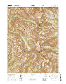
~ Isolation Peak CO topo map, 1:24000 scale, 7.5 X 7.5 Minute, 2016
Isolation Peak, Colorado, USGS topographic map dated 2016.
Includes geographic coordinates (latitude and longitude). This topographic map is suitable for hiking, camping, and exploring, or framing it as a wall map.
Printed on-demand using high resolution imagery, on heavy weight and acid free paper, or alternatively on a variety of synthetic materials.
Topos available on paper, Waterproof, Poly, or Tyvek. Usually shipping rolled, unless combined with other folded maps in one order.
- Product Number: USGS-8364444
- Free digital map download (high-resolution, GeoPDF): Isolation Peak, Colorado (file size: 31 MB)
- Map Size: please refer to the dimensions of the GeoPDF map above
- Weight (paper map): ca. 55 grams
- Map Type: POD USGS Topographic Map
- Map Series: US Topo
- Map Verison: Current
- Cell ID: 22177
- Datum: North American Datum of 1983
- Map Projection: Transverse Mercator
- Map Cell Name: Isolation Peak
- Grid size: 7.5 X 7.5 Minute
- Date on map: 2016
- Map Scale: 1:24000
- Geographical region: Colorado, United States
Neighboring Maps:
All neighboring USGS topo maps are available for sale online at a variety of scales.
Spatial coverage:
Topo map Isolation Peak, Colorado, covers the geographical area associated the following places:
- Fifth Lake - Junco Lake - Indigo Pond - Pagoda Mountain - Frigid Lake - Stone Lake - Pipit Lake - Bluebird Reservoir - Roaring Fork Trail - Mount Cairns - Eagles Beak - Lake Gibraltar - Chiefs Head Peak - North Ridge - Bluebird Lake - Moomaw Glacier - Spirit Lake - Castle Lake - Castle Lakes - Hutcheson Lakes - Lone Pine Lake - Lion Lake Number 2 - Crawford Lake - Cony Lake - Long Lake - Tanima Peak - Copeland Mountain - Keplinger Lake - Fox Park - Lion Lake Trail - Saint Vrain Glaciers - Lake of Many Winds - Chickadee Pond - Mount Alice - Mount Irving Hale - Eagle Lake - Elk Tooth - Saint Vrain Glacier Trail - Isolation Peak - Watanga Lake - Boulder-Grand Pass - Gourd Lake Trail - Fourth Lake - Andrews Peak - Buchanan Pass Trail - Gourd Lake - Ten Lake Park - Hiamovi Mountain - Paradise Park - Ouzel Peak - Isolation Lake - Pilot Mountain - Box Lake - Watanga Mountain - The Cleaver - Island Lake - Bluebird Lake Trail - Fan Falls - Mahana Peak - Thunder Lake - Bluebird Dam - Lark Pond - Upper Lake - Round Lake - Buchanan Pass - Lake Verna - Adams Lake - Cooper Peak - Mertensia Falls - Snowbank Lake - Lake Envy - Ogalalla Peak - Marten Peak - Cony Pass - Thunder Falls - Pear Reservoir - Lion Lake Number 1 - Falcon Lake - Watanga Creek - Ouzel Lake - Trio Falls - Mount Craig
- Map Area ID: AREA40.2540.125-105.75-105.625
- Northwest corner Lat/Long code: USGSNW40.25-105.75
- Northeast corner Lat/Long code: USGSNE40.25-105.625
- Southwest corner Lat/Long code: USGSSW40.125-105.75
- Southeast corner Lat/Long code: USGSSE40.125-105.625
- Northern map edge Latitude: 40.25
- Southern map edge Latitude: 40.125
- Western map edge Longitude: -105.75
- Eastern map edge Longitude: -105.625


