
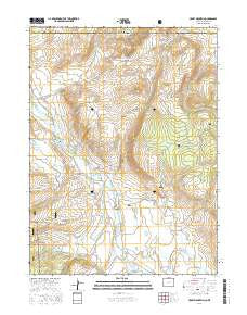
~ Crazy Mountain CO topo map, 1:24000 scale, 7.5 X 7.5 Minute, 2016
Crazy Mountain, Colorado, USGS topographic map dated 2016.
Includes geographic coordinates (latitude and longitude). This topographic map is suitable for hiking, camping, and exploring, or framing it as a wall map.
Printed on-demand using high resolution imagery, on heavy weight and acid free paper, or alternatively on a variety of synthetic materials.
Topos available on paper, Waterproof, Poly, or Tyvek. Usually shipping rolled, unless combined with other folded maps in one order.
- Product Number: USGS-8364420
- Free digital map download (high-resolution, GeoPDF): Crazy Mountain, Colorado (file size: 21 MB)
- Map Size: please refer to the dimensions of the GeoPDF map above
- Weight (paper map): ca. 55 grams
- Map Type: POD USGS Topographic Map
- Map Series: US Topo
- Map Verison: Current
- Cell ID: 10639
- Datum: North American Datum of 1983
- Map Projection: Transverse Mercator
- Map Cell Name: Crazy Mountain
- Grid size: 7.5 X 7.5 Minute
- Date on map: 2016
- Map Scale: 1:24000
- Geographical region: Colorado, United States
Neighboring Maps:
All neighboring USGS topo maps are available for sale online at a variety of scales.
Spatial coverage:
Topo map Crazy Mountain, Colorado, covers the geographical area associated the following places:
- Homestead Ditch 1 - Yelton Ditch - Pfister Draw - Granny Creek - Homestead Ditch 2 - Whiskey Springs - Smith Brown Ditch - Mansfield and Enlargement Ditch - Horse Ranch Pass - Hohnholz Lakes Campground - Red Mountain Pass - Little Hohnholz Lake - Jimmy Creek - Dempsey Dome - Trollop Creek - La Garde Ditch - Bluebell Creek - Jenkins Creek - Jimmy Creek Ditch - Frenchwoman Creek - McIntyre Creek - Pache Ditch - Crazy Mountain - Mansfield Ditch - Little Jenkins Creek - Red Mountain - Grace Creek - Lower La Garde Ditch - East Lake - La Garde Creek - Jim Ditch - Forrester Cemetery - Little Hohnholtz Dam - Hills Ditch - Forrester Creek - Forrester Ditch Number 1
- Map Area ID: AREA4140.875-106-105.875
- Northwest corner Lat/Long code: USGSNW41-106
- Northeast corner Lat/Long code: USGSNE41-105.875
- Southwest corner Lat/Long code: USGSSW40.875-106
- Southeast corner Lat/Long code: USGSSE40.875-105.875
- Northern map edge Latitude: 41
- Southern map edge Latitude: 40.875
- Western map edge Longitude: -106
- Eastern map edge Longitude: -105.875


