
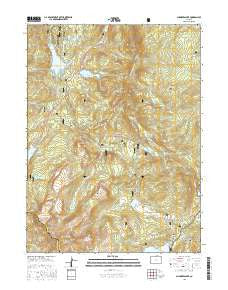
~ Chambers Lake CO topo map, 1:24000 scale, 7.5 X 7.5 Minute, 2016
Chambers Lake, Colorado, USGS topographic map dated 2016.
Includes geographic coordinates (latitude and longitude). This topographic map is suitable for hiking, camping, and exploring, or framing it as a wall map.
Printed on-demand using high resolution imagery, on heavy weight and acid free paper, or alternatively on a variety of synthetic materials.
Topos available on paper, Waterproof, Poly, or Tyvek. Usually shipping rolled, unless combined with other folded maps in one order.
- Product Number: USGS-8364414
- Free digital map download (high-resolution, GeoPDF): Chambers Lake, Colorado (file size: 29 MB)
- Map Size: please refer to the dimensions of the GeoPDF map above
- Weight (paper map): ca. 55 grams
- Map Type: POD USGS Topographic Map
- Map Series: US Topo
- Map Verison: Current
- Cell ID: 8099
- Datum: North American Datum of 1983
- Map Projection: Transverse Mercator
- Map Cell Name: Chambers Lake
- Grid size: 7.5 X 7.5 Minute
- Date on map: 2016
- Map Scale: 1:24000
- Geographical region: Colorado, United States
Neighboring Maps:
All neighboring USGS topo maps are available for sale online at a variety of scales.
Spatial coverage:
Topo map Chambers Lake, Colorado, covers the geographical area associated the following places:
- Aspen Glen Campground - Fall Creek - Willow Creek - Box Canyon - Iron Mountain Mine - Peterson Lake Trailhead - North Fork Joe Wright Creek - Willow Creek - Peterson Park - Zimmerman Crown Point Trailhead - Zimmerman Lake - Corral Park Cow Camp - Corral Creek Traihead - Chambers Lake Campground - Chambers Lake - Larimie Lake Dam - Corral Park - Neota Wilderness - Barnes Meadow Reservoir - Lost Lake Dam - Corral Park Trail - Sawmill Creek - May Creek - Blue Lake Trailhead - Lost Lake Fisherman Parking - Corral Creek - Big South Trail - Joe Wright Reservoir - Preachers Cabin - Grass Lake - Barnes Meadow Dam - Trap Lake - Long Draw Dam - Long Draw Campground - Peterson Lake Dam - Lost Lake Trailhead - Laramie Lake - Joe Wright Fisherman Parking - Iron Mountain - Flat Top Mountain - Peterson Lake - Zimmerman Lake Trailhead - Chambers Lake Dam - Trap Creek - Joe Wright Dam - Bald Mountain - Cascade Creek - Lost Lake - Trap Park
- Map Area ID: AREA40.62540.5-105.875-105.75
- Northwest corner Lat/Long code: USGSNW40.625-105.875
- Northeast corner Lat/Long code: USGSNE40.625-105.75
- Southwest corner Lat/Long code: USGSSW40.5-105.875
- Southeast corner Lat/Long code: USGSSE40.5-105.75
- Northern map edge Latitude: 40.625
- Southern map edge Latitude: 40.5
- Western map edge Longitude: -105.875
- Eastern map edge Longitude: -105.75


