
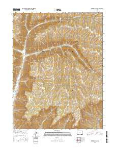
~ Forked Gulch CO topo map, 1:24000 scale, 7.5 X 7.5 Minute, 2016
Forked Gulch, Colorado, USGS topographic map dated 2016.
Includes geographic coordinates (latitude and longitude). This topographic map is suitable for hiking, camping, and exploring, or framing it as a wall map.
Printed on-demand using high resolution imagery, on heavy weight and acid free paper, or alternatively on a variety of synthetic materials.
Topos available on paper, Waterproof, Poly, or Tyvek. Usually shipping rolled, unless combined with other folded maps in one order.
- Product Number: USGS-8363872
- Free digital map download (high-resolution, GeoPDF): Forked Gulch, Colorado (file size: 29 MB)
- Map Size: please refer to the dimensions of the GeoPDF map above
- Weight (paper map): ca. 55 grams
- Map Type: POD USGS Topographic Map
- Map Series: US Topo
- Map Verison: Current
- Cell ID: 15815
- Datum: North American Datum of 1983
- Map Projection: Transverse Mercator
- Map Cell Name: Forked Gulch
- Grid size: 7.5 X 7.5 Minute
- Date on map: 2016
- Map Scale: 1:24000
- Geographical region: Colorado, United States
Neighboring Maps:
All neighboring USGS topo maps are available for sale online at a variety of scales.
Spatial coverage:
Topo map Forked Gulch, Colorado, covers the geographical area associated the following places:
- Spring Gulch - Short Water - Schoolhouse Point - East Fork Parachute Creek - East Forked Gulch - Trail Gulch - Ben Good Creek - Glover Point - Bull Gulch - Fatty Canyon - Grassy Gulch - Cherry Gulch - Davis Gulch - Corral Gulch - Chicken Gulch - Spring Gulch - Forked Gulch - Middle Water - Buck Gulch - West Fork Parachute Creek - Granlee Ditch - Deep Gulch - Granlee Gulch - Lindauer Point - West Forked Gulch - Gardner Gulch - Pete Spring Gulch - Trapper Creek - Bear Cabin Gulch - Pyramid Point - Lone Tree Spring - Buck Gulch - Bear Gulch - East Middle Fork Falls - Middle Fork Parachute Creek - East Middle Fork Parachute Creek - Short Ridge - Long Ridge - Tank Gulch - Sheep Trail Hollow - Cabin Water - Milk Cabin Gulch - Rulison Gulch - Allen Point - East Fork Falls - Helm Gulch - Northwater Creek
- Map Area ID: AREA39.62539.5-108.125-108
- Northwest corner Lat/Long code: USGSNW39.625-108.125
- Northeast corner Lat/Long code: USGSNE39.625-108
- Southwest corner Lat/Long code: USGSSW39.5-108.125
- Southeast corner Lat/Long code: USGSSE39.5-108
- Northern map edge Latitude: 39.625
- Southern map edge Latitude: 39.5
- Western map edge Longitude: -108.125
- Eastern map edge Longitude: -108


