
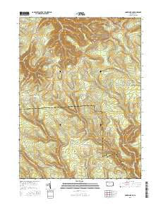
~ Snow Shoe NE PA topo map, 1:24000 scale, 7.5 X 7.5 Minute, 2016
Snow Shoe NE, Pennsylvania, USGS topographic map dated 2016.
Includes geographic coordinates (latitude and longitude). This topographic map is suitable for hiking, camping, and exploring, or framing it as a wall map.
Printed on-demand using high resolution imagery, on heavy weight and acid free paper, or alternatively on a variety of synthetic materials.
Topos available on paper, Waterproof, Poly, or Tyvek. Usually shipping rolled, unless combined with other folded maps in one order.
- Product Number: USGS-8264028
- Free digital map download (high-resolution, GeoPDF): Snow Shoe NE, Pennsylvania (file size: 30 MB)
- Map Size: please refer to the dimensions of the GeoPDF map above
- Weight (paper map): ca. 55 grams
- Map Type: POD USGS Topographic Map
- Map Series: US Topo
- Map Verison: Current
- Cell ID: 41914
- Datum: North American Datum of 1983
- Map Projection: Transverse Mercator
- Map Cell Name: Snow Shoe NE
- Grid size: 7.5 X 7.5 Minute
- Date on map: 2016
- Map Scale: 1:24000
- Geographical region: Pennsylvania, United States
Neighboring Maps:
All neighboring USGS topo maps are available for sale online at a variety of scales.
Spatial coverage:
Topo map Snow Shoe NE, Pennsylvania, covers the geographical area associated the following places:
- J U Branch - Burns Run Camp - Sowot Camp - Endless Mountain Camp - Triple Oaks Camp - Buck Harbor Camp - Dug Road Trail - Proctor Hollow - Coffin Rock Fire Tower - Spike Buck Camp - Wildcat Camp - Rainbow Trail - Bloody Run - Camp Rockspar - The Hemlocks Camp - Coon Run Trail - West Branch Big Run - Little Bear Run - Clear View Camp - Weaver Trail - Penrose - Swamp Branch Trail - Soldiers Home Camp (historical) - Bald Hill Hunting Club - Ralphton Camp - William Penn Camp (historical) - East Branch Big Run - Deer Lick Camp - Camp Podunk - Little Bear Trail - Panther Branch - Barneys Ridge - Fisher Hill Camp - Coon Run - Owl Hollow - Twin Pines Camp - Spring Run Camp - Fish Dam Trail - Little Beaver Camp - J U Branch Trail - Packer Fork - State Camp - Bloody Run Camp - Smiths Run Trail - Sproul State Forest - Dry Run Camp - Long Trail - Camp Chestnut Hill - Camp Big Horn - Panther Trail - Middle Branch Big Run - Bear Wallow Camps - Hendricks Trail - Fetzer Hollow - Fetzer Hollow Camp - Sinking Spring Branch - Lewis Camp - Walker Trail - Boiling Spring Camp - Bear Run - Tyro Camp
- Map Area ID: AREA41.2541.125-77.875-77.75
- Northwest corner Lat/Long code: USGSNW41.25-77.875
- Northeast corner Lat/Long code: USGSNE41.25-77.75
- Southwest corner Lat/Long code: USGSSW41.125-77.875
- Southeast corner Lat/Long code: USGSSE41.125-77.75
- Northern map edge Latitude: 41.25
- Southern map edge Latitude: 41.125
- Western map edge Longitude: -77.875
- Eastern map edge Longitude: -77.75


