
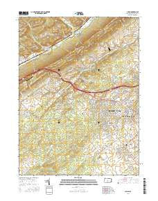
~ Julian PA topo map, 1:24000 scale, 7.5 X 7.5 Minute, 2016
Julian, Pennsylvania, USGS topographic map dated 2016.
Includes geographic coordinates (latitude and longitude). This topographic map is suitable for hiking, camping, and exploring, or framing it as a wall map.
Printed on-demand using high resolution imagery, on heavy weight and acid free paper, or alternatively on a variety of synthetic materials.
Topos available on paper, Waterproof, Poly, or Tyvek. Usually shipping rolled, unless combined with other folded maps in one order.
- Product Number: USGS-8259769
- Free digital map download (high-resolution, GeoPDF): Julian, Pennsylvania (file size: 29 MB)
- Map Size: please refer to the dimensions of the GeoPDF map above
- Weight (paper map): ca. 55 grams
- Map Type: POD USGS Topographic Map
- Map Series: US Topo
- Map Verison: Current
- Cell ID: 22865
- Datum: North American Datum of 1983
- Map Projection: Transverse Mercator
- Map Cell Name: Julian
- Grid size: 7.5 X 7.5 Minute
- Date on map: 2016
- Map Scale: 1:24000
- Geographical region: Pennsylvania, United States
Neighboring Maps:
All neighboring USGS topo maps are available for sale online at a variety of scales.
Spatial coverage:
Topo map Julian, Pennsylvania, covers the geographical area associated the following places:
- Ridgemont - Scotia - Briarly - Overlook Heights - Park Forest Village - Waddle - Bloomsdorf - Julian - Fillmore - Marysville - Matternville - Toftrees - Circle Ville - Woodycrest - Park Hills - Pine Hall - Buffalo Run - Krumrine - Struble
- Map Area ID: AREA40.87540.75-78-77.875
- Northwest corner Lat/Long code: USGSNW40.875-78
- Northeast corner Lat/Long code: USGSNE40.875-77.875
- Southwest corner Lat/Long code: USGSSW40.75-78
- Southeast corner Lat/Long code: USGSSE40.75-77.875
- Northern map edge Latitude: 40.875
- Southern map edge Latitude: 40.75
- Western map edge Longitude: -78
- Eastern map edge Longitude: -77.875


