
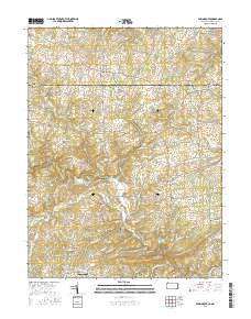
~ Fawn Grove PA topo map, 1:24000 scale, 7.5 X 7.5 Minute, 2016
Fawn Grove, Pennsylvania, USGS topographic map dated 2016.
Includes geographic coordinates (latitude and longitude). This topographic map is suitable for hiking, camping, and exploring, or framing it as a wall map.
Printed on-demand using high resolution imagery, on heavy weight and acid free paper, or alternatively on a variety of synthetic materials.
Topos available on paper, Waterproof, Poly, or Tyvek. Usually shipping rolled, unless combined with other folded maps in one order.
- Product Number: USGS-8248642
- Free digital map download (high-resolution, GeoPDF): Fawn Grove, Pennsylvania (file size: 26 MB)
- Map Size: please refer to the dimensions of the GeoPDF map above
- Weight (paper map): ca. 55 grams
- Map Type: POD USGS Topographic Map
- Map Series: US Topo
- Map Verison: Current
- Cell ID: 15083
- Datum: North American Datum of 1983
- Map Projection: Transverse Mercator
- Map Cell Name: Fawn Grove
- Grid size: 7.5 X 7.5 Minute
- Date on map: 2016
- Map Scale: 1:24000
- Geographical region: Pennsylvania, United States
Neighboring Maps:
All neighboring USGS topo maps are available for sale online at a variety of scales.
Spatial coverage:
Topo map Fawn Grove, Pennsylvania, covers the geographical area associated the following places:
- Willwood - Midsummer Hill - Cherrywood Estates - Belle Farm Heritage - Graceton - Harkins - Bushs Corner - North Harford Heights - Federal Hill - Rush Manor - Bobs Flow - Twin Ridge Estates - Wilsons Choice - Minefield - Harford Heritage - Whispering Woods - Dunsen Heights - Eden Hills - Spring Meadows - North Bend Heights - Northampton - Fawn Grove - Hoerr - Deer Meadows - Rockridge Forest - Street - Chrome Hill Estates - Spooners Creek - Coldstream - McDermott - Coventry Meadows - Highland Ridge - Quail Hills - Madonna Hills - Meadowlark Estates - Federal Hill Heights - Five Forks - Cherry Hill
- Map Area ID: AREA39.7539.625-76.5-76.375
- Northwest corner Lat/Long code: USGSNW39.75-76.5
- Northeast corner Lat/Long code: USGSNE39.75-76.375
- Southwest corner Lat/Long code: USGSSW39.625-76.5
- Southeast corner Lat/Long code: USGSSE39.625-76.375
- Northern map edge Latitude: 39.75
- Southern map edge Latitude: 39.625
- Western map edge Longitude: -76.5
- Eastern map edge Longitude: -76.375


