
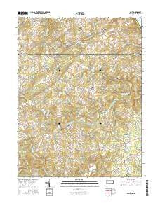
~ Delta PA topo map, 1:24000 scale, 7.5 X 7.5 Minute, 2016
Delta, Pennsylvania, USGS topographic map dated 2016.
Includes geographic coordinates (latitude and longitude). This topographic map is suitable for hiking, camping, and exploring, or framing it as a wall map.
Printed on-demand using high resolution imagery, on heavy weight and acid free paper, or alternatively on a variety of synthetic materials.
Topos available on paper, Waterproof, Poly, or Tyvek. Usually shipping rolled, unless combined with other folded maps in one order.
- Product Number: USGS-8248640
- Free digital map download (high-resolution, GeoPDF): Delta, Pennsylvania (file size: 26 MB)
- Map Size: please refer to the dimensions of the GeoPDF map above
- Weight (paper map): ca. 55 grams
- Map Type: POD USGS Topographic Map
- Map Series: US Topo
- Map Verison: Current
- Cell ID: 11900
- Datum: North American Datum of 1983
- Map Projection: Transverse Mercator
- Map Cell Name: Delta
- Grid size: 7.5 X 7.5 Minute
- Date on map: 2016
- Map Scale: 1:24000
- Geographical region: Pennsylvania, United States
Neighboring Maps:
All neighboring USGS topo maps are available for sale online at a variety of scales.
Spatial coverage:
Topo map Delta, Pennsylvania, covers the geographical area associated the following places:
- Mill Stone Estates - Highland View - Delta - Prospect - Bay Ridge - Kiah Estates - Poole - Ady Estates - Ady - Mill Green Acres - Deerfield - Poplar Grove - Mount Vernon Estates - McCanns Corner - West Bangor - Macton - Whiteford - Scenic View - Shawnee - Mill Green - Spring House Estates - Slate Hill - Pylesville - Bryansville - Pylesville Heights - Dublin - Saint Anne - Delano Acres - Viking Highlands - Cherby-Maurlyn Estates - Ailston - Highland (historical) - Cambria - Deer Park - Rock Manor - Cooper - Dublin Manor - Day Meadows - Scarboro - Cardiff - Sherrill Gardens
- Map Area ID: AREA39.7539.625-76.375-76.25
- Northwest corner Lat/Long code: USGSNW39.75-76.375
- Northeast corner Lat/Long code: USGSNE39.75-76.25
- Southwest corner Lat/Long code: USGSSW39.625-76.375
- Southeast corner Lat/Long code: USGSSE39.625-76.25
- Northern map edge Latitude: 39.75
- Southern map edge Latitude: 39.625
- Western map edge Longitude: -76.375
- Eastern map edge Longitude: -76.25


